


Reducing car dependency can improve air quality, increase access to jobs and opportunities, and help cities meet emissions reduction goals.
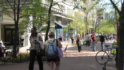
Like other cities around the country, Eugene, Oregon is "pushing several initiatives to promote '20-minute living,' the ability to reach important destinations like grocery stores and workplaces within that time frame." As reported by Haisten Willis in the Washington Post, city leaders want to make 90% of Eugene "20-minute friendly" by 2030, a goal that supporters say will improve air quality and resident health, raise property values, and reduce transportation costs.
Terri Harding, Eugene's principal planner for long-range planning, calls compact development and 20-minute neighborhoods the "pillars of growth management" for the city. The city's downtown, as a cultural and civic hub, is already a "gold-star 20-minute neighborhood," but "enhancing walkability farther out will be challenging."
Improving access isn't just about promoting biking and walking and enhancing transit. "Making cities more walkable involves creating a more compact footprint, where more businesses are built near existing homes. But it also means building housing near existing businesses, such as stores and restaurants." As deeply intertwined issues, transportation and land use must be approached simultaneously. "While the term '20-minute neighborhood' seems to refer primarily to transportation, it also speaks to land use. Planning and zoning are major factors as well, with more mixed-use and infill development needed to realize the vision."
FULL STORY: See you in 20 (or less): Living where access is within a short walk or bike ride

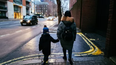
London Low-Emissions Zone Prompts Shift to Active Modes
More children are using active transportation modes to get to school in the wake of a policy that charges drivers to enter a low-emissions zone in central London.
How to Reduce Excess Vehicle Travel
Some experts claim that remote work is the most effective way to reduce vehicle travel, but my research indicates that improving and encouraging walking, bicycling, and public transit can provide larger impacts and benefits.

Partisan Splits for Transportation Politics
Researchers found that while left-leaning respondents were more likely to favor transportation reform and sustainable modes, conservatives are not as far behind as we think.

Planetizen Federal Action Tracker
A weekly monitor of how Trump’s orders and actions are impacting planners and planning in America.

Map: Where Senate Republicans Want to Sell Your Public Lands
For public land advocates, the Senate Republicans’ proposal to sell millions of acres of public land in the West is “the biggest fight of their careers.”

Restaurant Patios Were a Pandemic Win — Why Were They so Hard to Keep?
Social distancing requirements and changes in travel patterns prompted cities to pilot new uses for street and sidewalk space. Then it got complicated.

Platform Pilsner: Vancouver Transit Agency Releases... a Beer?
TransLink will receive a portion of every sale of the four-pack.

Toronto Weighs Cheaper Transit, Parking Hikes for Major Events
Special event rates would take effect during large festivals, sports games and concerts to ‘discourage driving, manage congestion and free up space for transit.”

Berlin to Consider Car-Free Zone Larger Than Manhattan
The area bound by the 22-mile Ringbahn would still allow 12 uses of a private automobile per year per person, and several other exemptions.
Urban Design for Planners 1: Software Tools
This six-course series explores essential urban design concepts using open source software and equips planners with the tools they need to participate fully in the urban design process.
Planning for Universal Design
Learn the tools for implementing Universal Design in planning regulations.
Heyer Gruel & Associates PA
JM Goldson LLC
Custer County Colorado
City of Camden Redevelopment Agency
City of Astoria
Transportation Research & Education Center (TREC) at Portland State University
Camden Redevelopment Agency
City of Claremont
Municipality of Princeton (NJ)