


Transportation demand models offer predictions that are used to make important decisions, but their accuracy is questionable. The real issue, however, might be about the goals of planning and how urban life and livability are quantified.
"Despite them being a legally required portion of any transportation infrastructure project that gets federal dollars, it is one of urban planning’s worst kept secrets that [travel demand] models are error-prone at best and fundamentally flawed at worst," writes Aaron Gordon.
Gordon says the primary issue is not so much whether these models could produce better results but rather why they are considered the best guides to make planning and policy decisions. "TDMs, its critics say, are emblematic of an antiquated planning process that optimizes for traffic flow and promotes highway construction. It’s well past time, they argue, to think differently about what we’re building for," says Gordon.
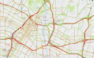
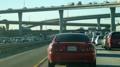
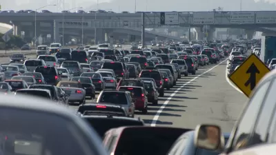
Gordon describes major issues with TDMs: assumptions about population, land-use patterns, and travel decision-making as fixed and predictable. The flip side, he says, is induced demand, where expanded roadway capacity does not relieve congestion but rather amplifies it. "To fully appreciate the absurdity of this quest, look no further than the $2.8 billion freeway project in Katy, Texas that was supposed to reduce commute times along the expanded 23-lane freeway, the widest in the world. All too predictably, congestion only increased, and commute times are longer still."
TDM critics say the focus should be on different measures that reflect quality-of-life issues such as access to public transit, parks, and walkable neighborhoods. “The question is not whether the predictions of how they will behave are accurate, but what kind of behavior we want to have more of,” adds Gordon.
FULL STORY: The Broken Algorithm That Poisoned American Transportation

If You Build It, Cars Will Come: the Common-Sense Logic of 'Induced Demand'
Highway expansion has been shown, time and again, to increase traffic and congestion. Cities are finally getting the message.
Failing to Account for Induced Traffic, Even When the Public Demands It
Induced traffic occurs when new highway capacity speeds up traffic, allowing travelers to drive further, increasing sprawl. A review of major highway project plans finds that most fail to accurately account for induced travel effects.
The 'Congestion Con' Debunked
New road capacity doesn't solve congestion, according to the central argument of a new report by Transportation for America.

Planetizen Federal Action Tracker
A weekly monitor of how Trump’s orders and actions are impacting planners and planning in America.

Map: Where Senate Republicans Want to Sell Your Public Lands
For public land advocates, the Senate Republicans’ proposal to sell millions of acres of public land in the West is “the biggest fight of their careers.”

Restaurant Patios Were a Pandemic Win — Why Were They so Hard to Keep?
Social distancing requirements and changes in travel patterns prompted cities to pilot new uses for street and sidewalk space. Then it got complicated.

Platform Pilsner: Vancouver Transit Agency Releases... a Beer?
TransLink will receive a portion of every sale of the four-pack.

Toronto Weighs Cheaper Transit, Parking Hikes for Major Events
Special event rates would take effect during large festivals, sports games and concerts to ‘discourage driving, manage congestion and free up space for transit.”

Berlin to Consider Car-Free Zone Larger Than Manhattan
The area bound by the 22-mile Ringbahn would still allow 12 uses of a private automobile per year per person, and several other exemptions.
Urban Design for Planners 1: Software Tools
This six-course series explores essential urban design concepts using open source software and equips planners with the tools they need to participate fully in the urban design process.
Planning for Universal Design
Learn the tools for implementing Universal Design in planning regulations.
Heyer Gruel & Associates PA
JM Goldson LLC
Custer County Colorado
City of Camden Redevelopment Agency
City of Astoria
Transportation Research & Education Center (TREC) at Portland State University
Camden Redevelopment Agency
City of Claremont
Municipality of Princeton (NJ)