


The public got its first taste of the ambitions of the Project Connect transit plan in the state capital of Texas.
"After months of speculation and rumors, officials Tuesday offered a glimpse at a massive transportation plan — which includes a downtown subway — aimed to usher in a new generation of transit for a growing city," reports Alyssa Gourd.
It was the first time potential details of the Project Connect transit plan were made public, according to Gourd.
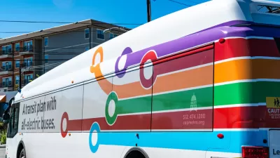
The plan is currently under development by the Austin City Council and Capital Metro Board. "The transit plans these groups are looking at range from $3.2-$10.2 billion, depending on the features they select," according to Gourd. "CapMetro explained they believe they can pay for 40% of this amount through federal grants." A public vote is one option for the remainder of funding.
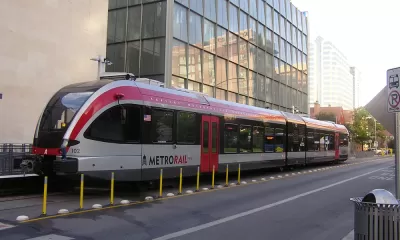
A separate article by Paul Livengood and Hank Cavagnaro summarizes the scope of Project Connect, at this early point in the planning process, thusly: "Capital Metro announced its Project Connect transit system on Tuesday, which includes more MetroRail options and the construction of an underground tunnel housing a light rail system in the Downtown Austin area."
"The tunnel is a portion of one of two proposed transitways designed to alleviate downtown traffic and prevent cars from getting stuck behind a transit vehicle, according to city documents," according to Livengood and Cavagnaro.
The Project Connect website lists four primary visions for the plan: transitways, better bus service, improved commuter rail, and new transit centers.
Planetizen first picked up news about Austin's intentions to complete a big, ambitious transit plan in November 2019.
FULL STORY: A subway in Austin? City leaders explore massive transit expansion


Transit Galore in Capital Metro's New Transit Plan for Austin
New light rail lines, dedicated busways, and expanded bus and commuter rail service are on the Project Connect menu.
Austin’s Project Connect Transit Plan Drastically Reduced
The details of drastic reductions to the proposed building program for Austin’s Project Connect long-range transit plan are now open for public comment.
Revisions Looming, Austin’s Project Connect Reveals the Obstacles of Transit Planning in 2023
A once sprawling and singularly ambitious capital investment plan for the Capital Metro system will soon be reduced in size and scope. The episode is more evidence of an emerging era of transit planning austerity.

Maui's Vacation Rental Debate Turns Ugly
Verbal attacks, misinformation campaigns and fistfights plague a high-stakes debate to convert thousands of vacation rentals into long-term housing.

Planetizen Federal Action Tracker
A weekly monitor of how Trump’s orders and actions are impacting planners and planning in America.

In Urban Planning, AI Prompting Could be the New Design Thinking
Creativity has long been key to great urban design. What if we see AI as our new creative partner?

King County Supportive Housing Program Offers Hope for Unhoused Residents
The county is taking a ‘Housing First’ approach that prioritizes getting people into housing, then offering wraparound supportive services.

Researchers Use AI to Get Clearer Picture of US Housing
Analysts are using artificial intelligence to supercharge their research by allowing them to comb through data faster. Though these AI tools can be error prone, they save time and housing researchers are optimistic about the future.

Making Shared Micromobility More Inclusive
Cities and shared mobility system operators can do more to include people with disabilities in planning and operations, per a new report.
Urban Design for Planners 1: Software Tools
This six-course series explores essential urban design concepts using open source software and equips planners with the tools they need to participate fully in the urban design process.
Planning for Universal Design
Learn the tools for implementing Universal Design in planning regulations.
planning NEXT
Appalachian Highlands Housing Partners
Mpact (founded as Rail~Volution)
City of Camden Redevelopment Agency
City of Astoria
City of Portland
City of Laramie