


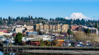
San Diego Mayor Kevin Faulconer is following up on an idea first pitched during a State of the City address, but with a few teaks.

San Diego planners recently outlined a policy proposal championed by Mayor Kevin Faulconer to eliminate height limits on new development near transit, reports Andrew Keatts.
The plan has evolved since Faulconer first announced it at the State of the City address earlier this year, explained by Keatts. "For instance, there would be no changes in single-family home neighborhoods. The policy would be limited to properties that already allow developers to build multi-family housing that are also within a half-mile of rail stations or bus stops where two lines with decent frequency operate."
The proposal also includes an optional height bonus program that will offer additional height to developers in exchange for community benefits, like affordable housing and public realm improvements.
Keatts lists a lot more specifics for the proposal, called the "Complete Communities," which includes specific actions on transportation, parks and recreation, and infrastructure. 2019 was momentous for planning in San Diego, after the city implemented eliminated parking minimums and debated inclusionary zoning fiercely before Mayor Faulconer vetoed a City Council ordinance in September.
FULL STORY: Mayor Rolls Out Long-Awaited Height Limit Elimination (Sorta) Plan

Sweeping Zoning Reforms Adopted in Olympia
The Olympia, Washington City Council adopted a new Housing Options Code Amendments ordinance, effectively eliminating single-family zoning in the city.
Major Parking Reform Effort Moving Forward in San Diego
Civic San Diego and San Diego planning commissioners approved new parking standards that would eliminate minimums and set maximums of one space per multifamily unit. Those reforms and more must still be approved by the City Council.
San Diego Could Scrap Parking Requirements in 'Transit Priority Areas'
The mayor of San Diego has introduced a major parking reform initiative.

Planetizen Federal Action Tracker
A weekly monitor of how Trump’s orders and actions are impacting planners and planning in America.

Map: Where Senate Republicans Want to Sell Your Public Lands
For public land advocates, the Senate Republicans’ proposal to sell millions of acres of public land in the West is “the biggest fight of their careers.”

Restaurant Patios Were a Pandemic Win — Why Were They so Hard to Keep?
Social distancing requirements and changes in travel patterns prompted cities to pilot new uses for street and sidewalk space. Then it got complicated.

DC Area County Eliminates Bus Fares
Montgomery County joins a growing trend of making transit free.

Platform Pilsner: Vancouver Transit Agency Releases... a Beer?
TransLink will receive a portion of every sale of the four-pack.

Toronto Weighs Cheaper Transit, Parking Hikes for Major Events
Special event rates would take effect during large festivals, sports games and concerts to ‘discourage driving, manage congestion and free up space for transit.”
Urban Design for Planners 1: Software Tools
This six-course series explores essential urban design concepts using open source software and equips planners with the tools they need to participate fully in the urban design process.
Planning for Universal Design
Learn the tools for implementing Universal Design in planning regulations.
Heyer Gruel & Associates PA
JM Goldson LLC
Custer County Colorado
City of Camden Redevelopment Agency
City of Astoria
Transportation Research & Education Center (TREC) at Portland State University
Camden Redevelopment Agency
City of Claremont
Municipality of Princeton (NJ)