


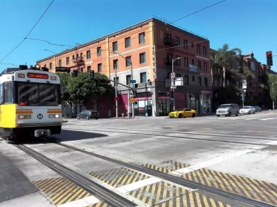
The city of Los Angeles controls the streets and the intersections crossed by the Expo Line as its connects Downtown Los Angeles to Santa Monic and the beach. The city has made its first progress toward prioritizing trains. at those intersections
Steven Sharp reports on changes proposed to service on the Metro Expo Line, one of the Los Angeles region's few transit ridership success stories of recent years.
An ordinance proposed by City Councilmember Mike Bonin "would instruct the Los Angeles Department of Transportation to maximize signal priority for the Expo Line at street crossings and report back to the City Council within 60 days on strategies to speed end-to-end travel times and improve on-time reliability by 90 percent," reports Sharp.
Currently, "the light rail line, which runs predominantly at-grade between Downtown Los Angeles and Santa Monica, is frequently forced to stop for cross traffic at 22 ungated intersections along its route," according to Sharp.
The trains are under the control of the Los Angeles County Metropolitan Transportation Authority, but those intersections are the responsibility of the city of Los Angeles. The lack of signal priority for Expo Line trains has been a popular talking point for transit advocates in the city pushing the city to live up to its promises about transitioning to a less car-centric transportation system. A bus route near Downtown Los Angeles, recently liberated from cars in a temporary bus-only lane, provided visual evidence of the benefits of prioritizing high-capacity modes of transportation.
The Expo Line recently gained attention when Metro cut service on the line and many other routes in the system, including bus routes. The public outcry was enough to convince metro to restore previous headways during peak travel times.
FULL STORY: L.A. City Councilman Wants to Speed Up the Expo Line

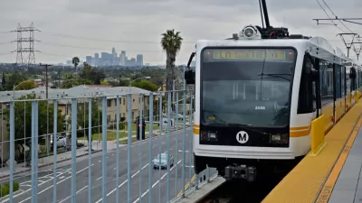
Traffic Signals Will Finally Prioritize Expo Line Trains in Los Angeles
The Los Angeles City Council has approved a motion to improve signal prioritization for the sake of light rail transit on the Expo Line where it operates in city streets.

LA to Replace Inglewood Light Rail Project With Bus Shuttles
LA Metro says the change is in response to community engagement and that the new design will be ready before the 2028 Olympic Games.

LA Metro Celebrates Bike Month With Free Rides, Discounted Bike Share
Skeptical about riding a bike in Los Angeles? Its transit agency wants to change your mind this May.

Planetizen Federal Action Tracker
A weekly monitor of how Trump’s orders and actions are impacting planners and planning in America.

Maui's Vacation Rental Debate Turns Ugly
Verbal attacks, misinformation campaigns and fistfights plague a high-stakes debate to convert thousands of vacation rentals into long-term housing.

San Francisco Suspends Traffic Calming Amidst Record Deaths
Citing “a challenging fiscal landscape,” the city will cease the program on the heels of 42 traffic deaths, including 24 pedestrians.

Defunct Pittsburgh Power Plant to Become Residential Tower
A decommissioned steam heat plant will be redeveloped into almost 100 affordable housing units.

Trump Prompts Restructuring of Transportation Research Board in “Unprecedented Overreach”
The TRB has eliminated more than half of its committees including those focused on climate, equity, and cities.

Amtrak Rolls Out New Orleans to Alabama “Mardi Gras” Train
The new service will operate morning and evening departures between Mobile and New Orleans.
Urban Design for Planners 1: Software Tools
This six-course series explores essential urban design concepts using open source software and equips planners with the tools they need to participate fully in the urban design process.
Planning for Universal Design
Learn the tools for implementing Universal Design in planning regulations.
Heyer Gruel & Associates PA
JM Goldson LLC
Custer County Colorado
City of Camden Redevelopment Agency
City of Astoria
Transportation Research & Education Center (TREC) at Portland State University
Jefferson Parish Government
Camden Redevelopment Agency
City of Claremont