


According to a newly released working paper, people in 20th century noticed the air and noise pollution and severed neighborhoods caused by freeways, and many of those people chose to move to the suburbs rather than deal with the nuisance.
The Federal Reserve Bank of Philadelphia released a working paper [pdf] recently that documents the detrimental effects of freeways on quality of life in central urban areas.
As explained in an article by Darryl C. Murphy, researchers at the Federal Reserve Bank of Philadelphia "took a broad look at how highways have contributed to suburbanization, and the subsequent decline of U.S. cities during the 20th century. "
"They found that between 1950 and 2010 highways slowed growth in income, population, and land values in city centers, while having the opposite effect in outlying areas," according to Murphy.
A key aspect of the narrative built in the paper is the history of "freeway revolts"—communities banding together to sway the final product of the Interstate highway system where it passed through urban areas. The study documents the changes these revolts were able to produce in the final freeway products of urban areas.
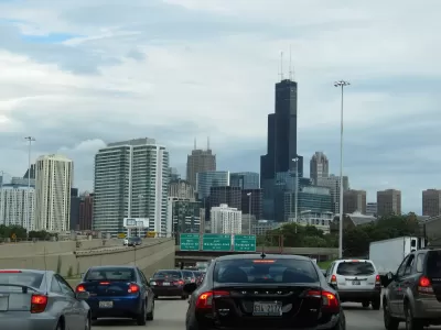
Despite the location of the authors who wrote this working paper, the research focuses specifically on examples from Boston, Chicago, and Detroit.
FULL STORY: Philly Fed economists: Here’s how highways ruined your city

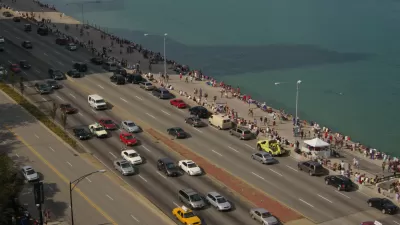
Bus Lanes, Desired by Advocates for Chicago's Lake Shore Drive Project, Back on the Table
After releasing a list of project alternatives that didn't include new bus lanes in the existing roadway, the Illinois Department of Transportation (IDOT) has changed its mind.
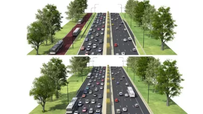
North Lake Shore Drive Redo Falls Short of Bus Priority Expectations
Strong criticisms of the project alternatives under consideration by the Illinois Department of Transportation for the closely watched North Lake Shore Drive project.
Research Quantifies the High Price of the Massachusetts Car Economy
Car culture isn't free, even for people who don't own cars.

Planetizen Federal Action Tracker
A weekly monitor of how Trump’s orders and actions are impacting planners and planning in America.

Map: Where Senate Republicans Want to Sell Your Public Lands
For public land advocates, the Senate Republicans’ proposal to sell millions of acres of public land in the West is “the biggest fight of their careers.”

Restaurant Patios Were a Pandemic Win — Why Were They so Hard to Keep?
Social distancing requirements and changes in travel patterns prompted cities to pilot new uses for street and sidewalk space. Then it got complicated.

Albuquerque Route 66 Motels Become Affordable Housing
A $4 million city fund is incentivizing developers to breathe new life into derelict midcentury motels.

DC Area County Eliminates Bus Fares
Montgomery County joins a growing trend of making transit free.

Platform Pilsner: Vancouver Transit Agency Releases... a Beer?
TransLink will receive a portion of every sale of the four-pack.
Urban Design for Planners 1: Software Tools
This six-course series explores essential urban design concepts using open source software and equips planners with the tools they need to participate fully in the urban design process.
Planning for Universal Design
Learn the tools for implementing Universal Design in planning regulations.
Heyer Gruel & Associates PA
JM Goldson LLC
Custer County Colorado
City of Camden Redevelopment Agency
City of Astoria
Transportation Research & Education Center (TREC) at Portland State University
Camden Redevelopment Agency
City of Claremont
Municipality of Princeton (NJ)