


Seattle is working toward its Vision Zero goals, after a year in which most people killed by drivers in the city were pedestrians.
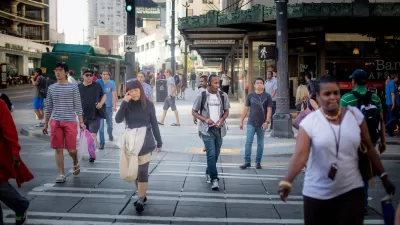
"The number of traffic fatalities and serious injuries in Seattle dipped only slightly last year from the previous year, leaving the city far from meeting its goal of eliminating all such deaths and injuries by 2030," reports Michelle Baruchman.
"Preliminary data from the Seattle Department of Transportation (SDOT) show 14 people died on city streets in 2018, down from 19 in 2017. An additional 170 people were seriously injured," adds Baruchman. "Most of last year’s traffic deaths — eight — were pedestrians, four were in vehicles, one was bicycling and one was on a motorcycle."
While any news of traffic facilities is disheartening, the city's work to reduce fatalities is making progress. Fatalities are down significantly from 2006, when the city reported 33. The city is also safer than other large cities in the country, according to the Dangerous By Design report from Smart Growth America and the National Complete Streets Coalition [pdf]. The news also offers an occasion for the city to discuss future projects that will further improve traffic safety, like plans to implement signals that give pedestrians a three- to seven-second head start at intersections. "The system, called leading pedestrian intervals, makes pedestrians in the crosswalk more visible to drivers making turns," explains Baruchman. "SDOT has equipped 43 intersections with the new systems, and has applied for grants to evaluate 140 more locations."
FULL STORY: Seattle traffic deaths and injuries down slightly last year; most of the fatalities were pedestrians

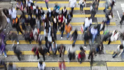
Big Cities Make Pedestrian Safety a Priority
New data released Dec. 19 by NHTSA shows increased safety for those traveling by car, but pedestrian fatalities are 15% higher than in 2009. Plans by San Francisco, Los Angeles, New York, and Chicago to increase ped safety are described by the WSJ.
Philly Speed Camera Program Cuts Fatalities in Half
Excessive speeding along dangerous segments of Roosevelt Boulevard dropped by 90 percent after the city installed automated enforcement cameras.
Seattle Road Safety Advocates Say Transportation Levy Perpetuates Car-Centric Status Quo
Critics of a proposed $1.3 billion transportation levy say the package isn’t enough to keep up with inflation and rising costs and fails to support a shift away from car-oriented infrastructure.

Planetizen Federal Action Tracker
A weekly monitor of how Trump’s orders and actions are impacting planners and planning in America.

Chicago’s Ghost Rails
Just beneath the surface of the modern city lie the remnants of its expansive early 20th-century streetcar system.

San Antonio and Austin are Fusing Into one Massive Megaregion
The region spanning the two central Texas cities is growing fast, posing challenges for local infrastructure and water supplies.

Since Zion's Shuttles Went Electric “The Smog is Gone”
Visitors to Zion National Park can enjoy the canyon via the nation’s first fully electric park shuttle system.

Trump Distributing DOT Safety Funds at 1/10 Rate of Biden
Funds for Safe Streets and other transportation safety and equity programs are being held up by administrative reviews and conflicts with the Trump administration’s priorities.

German Cities Subsidize Taxis for Women Amid Wave of Violence
Free or low-cost taxi rides can help women navigate cities more safely, but critics say the programs don't address the root causes of violence against women.
Urban Design for Planners 1: Software Tools
This six-course series explores essential urban design concepts using open source software and equips planners with the tools they need to participate fully in the urban design process.
Planning for Universal Design
Learn the tools for implementing Universal Design in planning regulations.
planning NEXT
Appalachian Highlands Housing Partners
Mpact (founded as Rail~Volution)
City of Camden Redevelopment Agency
City of Astoria
City of Portland
City of Laramie