


An institutional mandate isn't enough to make a design vision a reality. Portland is working on bringing its standards and guidelines in line with its ambition for protected bike lanes.
The Portland Bureau of Transportation (PBOT) is working on an official Portland Protected Bicycle Lane Design Guide that will provide clear guidance on protected bike lanes in the city.
Jonathan Maus reports that the guide will be the first of its kind for protected bike lanes in the city, and its significance goes even further than its lack of precedence.
PBOT Bicycle Program Manager Roger Geller recently told a public audience that "the guide came about in large part because outgoing PBOT Director Leah Treat issued an internal agency directive in 2015 that called on staff to make protected bike lanes the default whenever possible."
When it comes to building bike lanes in Portland, protected lanes are the preference. "We’re going to start with a protected bike lane and you better have a really good reason why can’t do it," Geller is quoted as saying in the article.
Maus got a preview of the guide at the same event, and he provides details about what he learned. For instance: "The bulk of the guide lays out different street cross-sections and suggests seven basic designs. This is meant to help city staff determine what’s possible given nearly any street configuration they come across — from a 76-foot wide, two way road to a 44-foot one-way road." The final produce will include an online tool that allows "plug-and-play" design and engineering functionality.
FULL STORY: A sneak peek at Portland’s new protected bike lane design guide


Portland and Multnomah County Push for Lower Speed Limits on Bridges
The Portland Bureau of Transportation and Multnomah County agree on a 30 mph speed limit on five downtown bridges, but the state's department of transportation denied the change on two key spans.
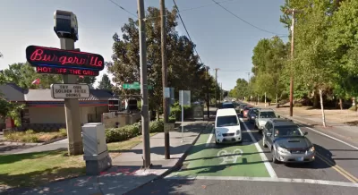
A Thorough, Mixed Review for a New Protected Bike Lane in Seattle
So many highly anticipated bike facilities finally deliver only to fall short of real game changing status. Seattle provides the latest example of the phenomenon in the wild.
Bike Lane Debate Continues in San Antonio
As a project to re-engineer Broadway in San Antonio continues, questions about where to put bike lanes persist.

Planetizen Federal Action Tracker
A weekly monitor of how Trump’s orders and actions are impacting planners and planning in America.

Map: Where Senate Republicans Want to Sell Your Public Lands
For public land advocates, the Senate Republicans’ proposal to sell millions of acres of public land in the West is “the biggest fight of their careers.”

Restaurant Patios Were a Pandemic Win — Why Were They so Hard to Keep?
Social distancing requirements and changes in travel patterns prompted cities to pilot new uses for street and sidewalk space. Then it got complicated.

Platform Pilsner: Vancouver Transit Agency Releases... a Beer?
TransLink will receive a portion of every sale of the four-pack.

Toronto Weighs Cheaper Transit, Parking Hikes for Major Events
Special event rates would take effect during large festivals, sports games and concerts to ‘discourage driving, manage congestion and free up space for transit.”

Berlin to Consider Car-Free Zone Larger Than Manhattan
The area bound by the 22-mile Ringbahn would still allow 12 uses of a private automobile per year per person, and several other exemptions.
Urban Design for Planners 1: Software Tools
This six-course series explores essential urban design concepts using open source software and equips planners with the tools they need to participate fully in the urban design process.
Planning for Universal Design
Learn the tools for implementing Universal Design in planning regulations.
Heyer Gruel & Associates PA
JM Goldson LLC
Custer County Colorado
City of Camden Redevelopment Agency
City of Astoria
Transportation Research & Education Center (TREC) at Portland State University
Camden Redevelopment Agency
City of Claremont
Municipality of Princeton (NJ)