


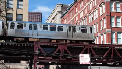
The Chicago Transit Authority's Red-Purple Bypass Project will add an additional track to speed up trains passing through the Belmont Station. The project requires the demolition of several neighborhood buildings.
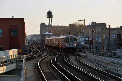
This week, buildings will start coming down to make room for new track coming into the Chicago Transit Authority's (CTA) Belmont train stop. "The demolition begins more than a year before the city plans to break ground on the flyover, which aims to unclog the bottleneck of Red, Brown and Purple Line trains that flow in and out of the Belmont Avenue station," Mary Wisniewski and Ese Olumhense write in the Chicago Tribune. The Red-Purple Bypass Project was first proposed in 2014, provoking criticism throughout the planning and funding phases.
The new flyover aims to speed traffic through the busy station. "The planned flyover calls for a bypass that would take Brown Line trains above Red and Purple Line trains north of the busy Belmont station. Currently, Brown Line trains have to the cross tracks of other lines before they can proceed north, forcing Red and Purple Line trains to wait," Wisniewski and Olumhense report. The CTA says that extra track would translate to 15 more trains through the station an hour.
Some neighbors complain that the added speed is not enough to justify tearing down 14 buildings or the projects cost. "The CTA has spent $32 million on real estate acquisitions and relocation costs for the bypass, while demolition is expected to cost an additional $3 million," Wisniewski and Olumhense write.
FULL STORY: Demolition of Lakeview buildings to begin this week for CTA 'flyover' project

No Fare Hikes for Chicago in 2019 Budget
The Chicago Transit Agency 2019 includes a flyover at the Belmont train station, rehabs for two Blue Line stops, and Red and Purple Line modernizations, among other things.
Major Ride Share Companies Accused of Taking Advantage of CTA Fatality
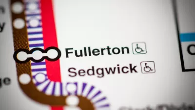
An apparent suicide stopped trains Tuesday morning at the Fullerton stop, which serves as a hub for Chicago's North Side transit. Prices for a ride from the area to downtown via Lyft reached triple digits.
Apartments Zoned Out of Near North Side Chicago Train Stations
Zoning around Chicago's public transit in relatively affluent areas won't allow for density or any kind of housing other than single family homes.

Planetizen Federal Action Tracker
A weekly monitor of how Trump’s orders and actions are impacting planners and planning in America.

Map: Where Senate Republicans Want to Sell Your Public Lands
For public land advocates, the Senate Republicans’ proposal to sell millions of acres of public land in the West is “the biggest fight of their careers.”

Restaurant Patios Were a Pandemic Win — Why Were They so Hard to Keep?
Social distancing requirements and changes in travel patterns prompted cities to pilot new uses for street and sidewalk space. Then it got complicated.

Platform Pilsner: Vancouver Transit Agency Releases... a Beer?
TransLink will receive a portion of every sale of the four-pack.

Toronto Weighs Cheaper Transit, Parking Hikes for Major Events
Special event rates would take effect during large festivals, sports games and concerts to ‘discourage driving, manage congestion and free up space for transit.”

Berlin to Consider Car-Free Zone Larger Than Manhattan
The area bound by the 22-mile Ringbahn would still allow 12 uses of a private automobile per year per person, and several other exemptions.
Urban Design for Planners 1: Software Tools
This six-course series explores essential urban design concepts using open source software and equips planners with the tools they need to participate fully in the urban design process.
Planning for Universal Design
Learn the tools for implementing Universal Design in planning regulations.
Heyer Gruel & Associates PA
JM Goldson LLC
Custer County Colorado
City of Camden Redevelopment Agency
City of Astoria
Transportation Research & Education Center (TREC) at Portland State University
Camden Redevelopment Agency
City of Claremont
Municipality of Princeton (NJ)