


When it's said that most people live in cities, a significant portion of that number are people living in suburbs near cities. A new map shows just how far everyone travels to get to a big city.
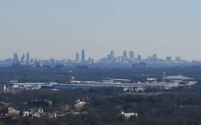
Jessica Stewart shares news of a new mapping project by the University of Oxford's Malaria Atlas Project, published by the journal Nature, by citing the oft-quoted-but-largely-misleading statistic about 50 percent of the world's population living in cities. The study's findings are more nuanced than that lede-friendly nugget: in 2015, 80.7% of all people lived within an hour of a city.
Other findings of the study including insight into the geography of poverty:
In some areas, like sub-Saharan Africa, access to the city is also a large indicator of wealth, with only 50% of people living in low-income areas residing within an hour of the city. This is in stark contrast to people living in high-income areas, as 90.7% of these individuals can reach the city in less than an hour.
The Malaria Atlas Project made its findings public as an interactive online map and data explorer.
FULL STORY: New Map Shows How Long It Takes People Around the World to Travel to the Nearest City


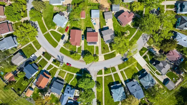
How to Define the Suburban: HUD Survey Sheds New Light
A new HUD survey could help change the way the federal government defines the "suburban"—a notoriously tricky proposition.
In More Metros Than You’d Think, Suburbs are Now More Expensive Than the City
If you're moving to the burbs to save on square footage, data shows you should think again.

Renters Now Outnumber Homeowners in Over 200 US Suburbs
High housing costs in city centers and the new-found flexibility offered by remote work are pushing more renters to suburban areas.

Planetizen Federal Action Tracker
A weekly monitor of how Trump’s orders and actions are impacting planners and planning in America.

Maui's Vacation Rental Debate Turns Ugly
Verbal attacks, misinformation campaigns and fistfights plague a high-stakes debate to convert thousands of vacation rentals into long-term housing.

Restaurant Patios Were a Pandemic Win — Why Were They so Hard to Keep?
Social distancing requirements and changes in travel patterns prompted cities to pilot new uses for street and sidewalk space. Then it got complicated.

In California Battle of Housing vs. Environment, Housing Just Won
A new state law significantly limits the power of CEQA, an environmental review law that served as a powerful tool for blocking new development.

Boulder Eliminates Parking Minimums Citywide
Officials estimate the cost of building a single underground parking space at up to $100,000.

Orange County, Florida Adopts Largest US “Sprawl Repair” Code
The ‘Orange Code’ seeks to rectify decades of sprawl-inducing, car-oriented development.
Urban Design for Planners 1: Software Tools
This six-course series explores essential urban design concepts using open source software and equips planners with the tools they need to participate fully in the urban design process.
Planning for Universal Design
Learn the tools for implementing Universal Design in planning regulations.
Heyer Gruel & Associates PA
JM Goldson LLC
Custer County Colorado
City of Camden Redevelopment Agency
City of Astoria
Transportation Research & Education Center (TREC) at Portland State University
Jefferson Parish Government
Camden Redevelopment Agency
City of Claremont