


World
Global issues, U.N., etc.
9 New Navigation Technologies for the Visually Impaired
New technology could open a new era of independence for blind and visually impaired residents of communities everywhere.
Mapbox's Landsat-Live Presents Satellite Imagery in Near-Real Time
Until last week, the seasons never changed on satellite image software. But Mapbox's Landsat-Live program shares clear images of the Earth's surface in near-real time.
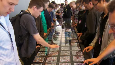
A Song for (Almost) Every City
An intrepid developer has combined the powers of OpenStreetMap, Wikipedia, and Spotify to map 7,681 songs about 212 cities across the globe.
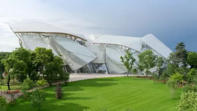
Op-Ed: Starchitecture Fails the Future
An addiction to spectacle and fad, says Peter Buchanan, has set architecture adrift in a sea of meaningless forms. And real design problems go ignored.
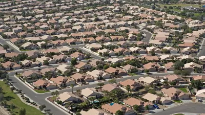
Study: Sprawl Costs the U.S. Economy $1 Trillion Annually
A major new study estimates that sprawl costs the U.S. economy more than a trillion dollars annually, and results, in part, from planning and market distortions. Smart policy reforms can result in more efficient and equitable development.
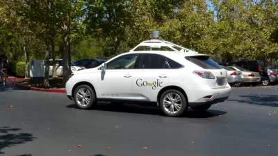
On the Self-Driving Car's Taste in Maps
The navigational software of successful driverless cars will make Google Maps seem like child's play. But can such a system replace or improve upon human instinct and adaptability?

Redefining Public Spaces for Older People
The elderly population in cities is growing, and research points to the health benefits of an active, connected lifestyle. So why are cities still so inhospitable to aging?

Study: Transit Subsidies Work Best Alone
Research suggests that transit subsidies produce minimal social value when combined with congestion pricing and dedicated bus lanes.
Global Suburbanisms: Beyond the White Picket Fence
With more people gravitating toward cities than ever before, new urban morphologies are proliferating throughout the world. Arup Connect's Sarah Wesseler talks with Roger Keil of York University about challenges facing global suburban development.
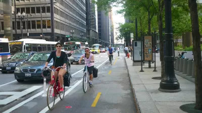
12 Studies that Make a Case for Converting Parking to Bike Lanes
CityLab has complied a thorough guide of economic impact studies of bike lanes that provides a clear, visual case for removing parking spaces.
Report: 2014 Carbon Emissions Down as World's Economy Grows
A recent report offers optimism that will world is making progress in the right direction to reduce carbon emissions.

On the Psychology of Road Rage
Few of us are fully immune from the effects of road rage. Psychologists are asking why driving can provoke changes in behavior—and how to avert them.

The Four Phases of New Urbanism
Robert Steuteville discusses the slow, phased emergence of the New Urbanism. We are only partway through a change that will take generations. We are now immersed in the revitalization of cities. More phases will come.
Why Coding Can Teach Planners How to Be More Creative
I want to learn HTML and CSS, or maybe get a refresher on the current state of web technology—where should I start?
A History of 'Urban Dashboards' and their Impact on City Governance
Welcome to the age of "Dashboard Governance"—when a good user interface offers the potential for performance advantages to city management.

Study: Dynamic Road Signs Make for Better Drivers
A psychological experiment finds that warning signs depicting more movement gain more attention, making drivers navigate more carefully.

A Modest Proposal: A Scientific Method for the Beauty of Cities
Alain de Botton has an idea that beauty is not in the eye of the beholder, when it comes to cities anyways. He also proposes a system for evaluating the beauty of the world's cities (spoiler: most cities don't qualify).
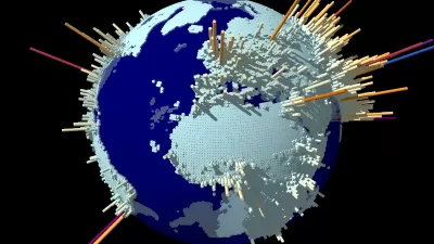
Visualizing the Spread of the OpenStreetMap Project
OpenStreetMap has released an animated map to illustrate the impressive growth of the project over the first ten years of its existence.
How Dense Cities Reap Green Benefits
What they may lack in peace and quiet, crowded cities more than make up for by requiring residents to live smaller. Tangible environmental benefits follow.
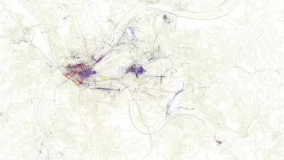
Friday Eye Candy: Maps Reveal Differences in How Locals and Tourists See the City
The cities that visitors see will always be different than the city that locals see. A new mapping project reveals the distinctions between the local perspective and the tourist perspective for 136 cities around the globe.
Urban Design for Planners 1: Software Tools
This six-course series explores essential urban design concepts using open source software and equips planners with the tools they need to participate fully in the urban design process.
Planning for Universal Design
Learn the tools for implementing Universal Design in planning regulations.
Heyer Gruel & Associates PA
JM Goldson LLC
Custer County Colorado
City of Camden Redevelopment Agency
City of Astoria
Transportation Research & Education Center (TREC) at Portland State University
Jefferson Parish Government
Camden Redevelopment Agency
City of Claremont


