


New technology could open a new era of independence for blind and visually impaired residents of communities everywhere.
A post on Urbanful by Njaimeh lists nine technology advancements that are providing new ways for the visually impaired to navigate the city. The nine innovations fall into three categories: wearable tech, apps, and hybrids, but each of them offer new levels of independence for the visually impaired. A few examples:
- Smart glasses: For people with some vision remaining, this technology uses "connected cameras, a compass, GPS unit, gyroscope, headphones, and displays, the glasses can display varying lightness and darkness to indicate depth, and can also be made to recognize signs and transit numbers." Such technology is being developed in Oxford and Mexico.
- Blind Square: the most popular app for the blind and visually impaired, Blind Square "works with third-party navigation apps to describe the environment, announce points of interest, and let users know when they’ve reached an intersection."
FULL STORY: 9 advances helping visually-impaired people navigate cities


House Bill 'Guts' ADA Enforcement for Public Places
Designed to thwart predatory lawsuits, the bill could make it easier for businesses to ignore barriers to access, disability rights advocates say.
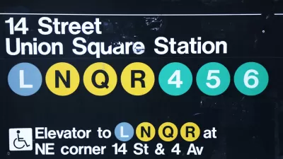
Op-Ed: L Train Closure Offers 'Once-in-a-Generation' Opportunity to Improve ADA Compliance
The New York subway might lead the nation in terms of reach and ridership, but it still lags behind other rail systems in the country on one critical point: access to people with special needs.

House Bill Would Add Red Tape to Americans With Disabilities Act Protections
An underreported bill in the current congressional session would create a waiting period for Americans with Disabilities Act claims.

Maui's Vacation Rental Debate Turns Ugly
Verbal attacks, misinformation campaigns and fistfights plague a high-stakes debate to convert thousands of vacation rentals into long-term housing.

Planetizen Federal Action Tracker
A weekly monitor of how Trump’s orders and actions are impacting planners and planning in America.

In Urban Planning, AI Prompting Could be the New Design Thinking
Creativity has long been key to great urban design. What if we see AI as our new creative partner?

Portland Raises Parking Fees to Pay for Street Maintenance
The city is struggling to bridge a massive budget gap at the Bureau of Transportation, which largely depleted its reserves during the Civd-19 pandemic.

Spokane Mayor Introduces Housing Reforms Package
Mayor Lisa Brown’s proposals include deferring or waiving some development fees to encourage more affordable housing development.

Houston Mayor Kills Another Bike Lane
The mayor rejected a proposed bike lane in the Montrose district in keeping with his pledge to maintain car lanes.
Urban Design for Planners 1: Software Tools
This six-course series explores essential urban design concepts using open source software and equips planners with the tools they need to participate fully in the urban design process.
Planning for Universal Design
Learn the tools for implementing Universal Design in planning regulations.
Gallatin County Department of Planning & Community Development
Heyer Gruel & Associates PA
JM Goldson LLC
City of Camden Redevelopment Agency
City of Astoria
Transportation Research & Education Center (TREC) at Portland State University
Jefferson Parish Government
Camden Redevelopment Agency
City of Claremont