


Technology

Seeing the Los Angeles River in Whole New Way
We seem to have an app for everything. Now we have one that walks a viewer through the river’s history from the pre-historic era to the present.

Resilient Los Angeles: Preparing for Overlapping Disasters in Pandemic
L.A. City Chief Resilience Officer Aaron Gross elaborates on how the pandemic is shaping the city’s understanding of resilience and the cascading impact that overlapping disasters of earthquake or wildfire could have on the city’s limited resources.

Mobility-as-a-Service Still Searching for a Market Foothold
Policymakers and venture capital firms love the idea of Mobility-as-a-Service. The public hasn't proven as receptive, despite the willingness to download apps by the millions.

Ride-Hailing Companies Have Yet to Recover
While public transit tends to make the most headlines for coronavirus-damaged ridership numbers, ride-hailing companies like Uber and Lyft aren't exactly raking in new customers.
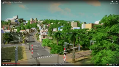
Cities: Skylines as an Urban Planning Tool
Computer simulations continue to play a novel and important role in urban planning, especially in finding new ways to engage the public and add some fun to the process of planning for the future of cities.

Do You Know Your COVID-19 Colors?
Harvard University's Global Health Insititute and Edmond J. Safra Center for Ethics have launched a new online tool for planners, policy makers, and the public to determine the severity of the coronavirus outbreak in one's county and state.

Growing Use of Trails Highlights the Work of Trail Planners
Trails have become very popular during the COVID-19 pandemic. Find out more about how trail planners in L.A. County plan for multi-use trails and promote the safe use of trails.

How GIS Helps Plan Parks
With constrained budgets, a geographic information system (GIS) may seem like a luxury for parks agencies. But to perform data-driven planning and advance park equity, GIS is an indispensable tool.
From Ventilators to Ventilation: The Shifting Focus of the Pandemic
Ventilator availability is a major indicator for states in the South and West that are seeing record hospitalizations, but in New York, where Gov. Cuomo announced that New York City had moved to Phase III of reopening, the topic was ventilation.

19 Ways to Redesign the World in the Covid-19 Era
POLITICO Magazine surveyed designers, architects, planners, doctors, psychologists, logisticians, and others, asking them how they would redesign the world for the Covid-19 era and beyond.
New Opportunities for Big Data in Pandemic-Era Urban Planning
Big data startups and corporations are collecting information that can help planners make informed decisions about how to facilitate social distancing. Will planners center data-driven decisions in other planning processes?
Pilot Projects Launched to Test Coordinated Curb Use
Coord, a Sidewalk Labs spinoff, has selected the winners of the inaugural Digital Curb Challenge.
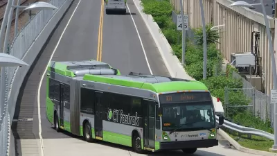
First: Grant Enables Automated Transit Buses in Connecticut
CTtransit will work with Robotic Research LLC, New Flyer of America, and the Center for Transportation and Environment to be the first public transit provider in the United States to operate full-sized, autonomous buses.

GIS Community Brings Maps to the Coronavirus Fight
Data-Smart City Solutions at the Harvard Kennedy School is monitoring the use of GIS technology to inform the public health response to the coronavirus pandemic.

Electric Bikes and Scooters Legalized in New York City
The City Council has legalized electric scooters and bikes. A citywide shared electric scooter pilot program is expected by early 2021.
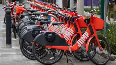
The Fall of JUMP Bikes
An exposé of the dramatic rise and fall of JUMP bikes under the ownership of Uber, in partnership with cities all over the United States.

Website Predicts Crowds to Inform Social Distancing on Buses and Trains
Know before you go.

Pandemic Data for Planners
The right data will be critical in crafting effective responses to the threats posed by the coronavirus.

The Key to Self-Driving Safety: Priority Over Expediency
Human drivers are fallible. Can automated systems do a better job to reduce the likelihood of car collisions?

North Texas Cities Organize Regional Recovery Efforts
A consortium of cities and regional organizations have created the new nonprofit known as the North Texas Innovation Alliance.
Urban Design for Planners 1: Software Tools
This six-course series explores essential urban design concepts using open source software and equips planners with the tools they need to participate fully in the urban design process.
Planning for Universal Design
Learn the tools for implementing Universal Design in planning regulations.
Gallatin County Department of Planning & Community Development
Heyer Gruel & Associates PA
JM Goldson LLC
City of Camden Redevelopment Agency
City of Astoria
Transportation Research & Education Center (TREC) at Portland State University
Jefferson Parish Government
Camden Redevelopment Agency
City of Claremont


