


Trails have become very popular during the COVID-19 pandemic. Find out more about how trail planners in L.A. County plan for multi-use trails and promote the safe use of trails.

In the midst of the COVID-19 pandemic, trails have become very popular as more and more people venture outside for recreation. In fact, some trails have become so popular that park agencies have had to implement online reservation and other systems to ensure physical distancing and regulate the number of trail users, especially on weekends.
The Los Angeles County Department of Parks and Recreation (DPR) is an example of one of these agencies as it started to offer timed entry reservations in early June for entrance to the popular Eaton Canyon Natural Area and access to the trail system. Timed entry reservations are free and intended to help keep the Eaton Canyon trails from becoming overcrowded and allow enough space for trail users to maintain physical distancing of six feet, in accordance with COVID-19 restrictions. In May, an overwhelming influx of visitors not adhering to the requirements for face coverings and physical distancing forced the closure of the Eaton Canyon Natural Area.
In this article, L.A. County park planner Clement Lau offers a behind-the-scenes look at the important trail planning work that is done by DPR. Specifically, its Trails Planning Section is responsible for a wide range of multi-use trail planning projects that serve hikers, equestrians, and mountain bikers in a variety of settings, including rural, suburban, and urban areas. Adopted by the L.A. County Board of Supervisors in December 2018, Phase II of the Santa Susana Mountains Trails Master Plan is the most recently completed trails master plan and includes a 67.5-mile, planned regional trail network within a 22-square-mile study area.
Developed with substantial input from stakeholders, the master plan recommends improvements to existing trails, proposes new trails, and identifies key connections and prime destinations within and adjacent to the study area in the Santa Clarita Valley and the northern foothills of the Santa Susana Mountains. DPR has also developed an updated trails website and the Trails LA County mobile app, both of which were launched just before National Trails Day on June 1, 2019. The refreshed website and new mobile app promote the use of trails and inform the public of the value and importance of stewardship, conservation, and habitat restoration of open space.
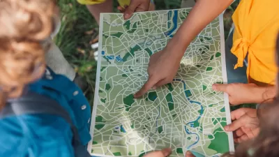
To meet the public’s need for trail-related information, both the website and app offer digital tools, including information on real-time alerts, maps, weather, trail length, elevation, difficulty level, rest stops, picnic locations, and much more. Read this article to learn more about trail planning and gain an appreciation for the thoughtfulness and care with which trail planners approach their work.
FULL STORY: Trails On The Brain


How GIS Helps Plan Parks
With constrained budgets, a geographic information system (GIS) may seem like a luxury for parks agencies. But to perform data-driven planning and advance park equity, GIS is an indispensable tool.

New Book Shows How Geographic Technology Tackles Global Challenges
In his new book, Jack Dangermond explores the transformative impact of GIS technology in solving global challenges through spatial data, highlighting its widespread application across sectors and its potential to design sustainable futures.
Building Healthier Communities: The Role of GIS in Park Planning
Integrating Geographic Information Systems (GIS) into park planning enhances community health by promoting physical activity, supporting mental well-being, fostering social connectedness, and addressing public health crises and climate change.

Maui's Vacation Rental Debate Turns Ugly
Verbal attacks, misinformation campaigns and fistfights plague a high-stakes debate to convert thousands of vacation rentals into long-term housing.

Planetizen Federal Action Tracker
A weekly monitor of how Trump’s orders and actions are impacting planners and planning in America.

In Urban Planning, AI Prompting Could be the New Design Thinking
Creativity has long been key to great urban design. What if we see AI as our new creative partner?

King County Supportive Housing Program Offers Hope for Unhoused Residents
The county is taking a ‘Housing First’ approach that prioritizes getting people into housing, then offering wraparound supportive services.

Researchers Use AI to Get Clearer Picture of US Housing
Analysts are using artificial intelligence to supercharge their research by allowing them to comb through data faster. Though these AI tools can be error prone, they save time and housing researchers are optimistic about the future.

Making Shared Micromobility More Inclusive
Cities and shared mobility system operators can do more to include people with disabilities in planning and operations, per a new report.
Urban Design for Planners 1: Software Tools
This six-course series explores essential urban design concepts using open source software and equips planners with the tools they need to participate fully in the urban design process.
Planning for Universal Design
Learn the tools for implementing Universal Design in planning regulations.
planning NEXT
Appalachian Highlands Housing Partners
Mpact (founded as Rail~Volution)
City of Camden Redevelopment Agency
City of Astoria
City of Portland
City of Laramie