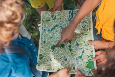
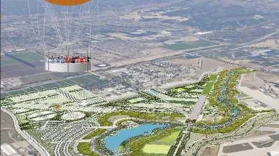
Integrating Geographic Information Systems (GIS) into park planning enhances community health by promoting physical activity, supporting mental well-being, fostering social connectedness, and addressing public health crises and climate change.

In today's urban environments, parks play a crucial role in enhancing physical, mental, and social well-being. As Este Geraghty shares in this article, the integration of Geographic Information Systems (GIS) into park planning and management has revolutionized how these green spaces are designed, ensuring they meet the diverse needs of communities. By analyzing data on park usage and mapping activity hotspots, GIS allows planners to optimize parks for physical activity, providing necessary facilities such as jogging paths and sports courts. This approach not only encourages more frequent and intense physical activity but also helps prevent chronic diseases like obesity and cardiovascular issues.
GIS technology is also instrumental in supporting mental health by improving access to parks and green spaces, which offer a respite from the stressors of urban life. By conducting gap analyses, planners can identify underserved communities and guide investments to improve park access, ensuring that all residents have the opportunity to benefit from these natural settings. Furthermore, GIS can help design therapeutic landscapes within parks that include elements like water features and greenery, which are proven to lower depression levels among individuals with regular park access.
Beyond individual health benefits, parks serve as vital communal spaces that foster social connectedness, a key component of overall well-being. GIS helps planners understand how parks are used for social interaction, allowing them to enhance these areas with amenities that encourage gatherings, such as picnic spots and playgrounds. Importantly, involving community members in the planning process through GIS visualization tools ensures that parks are designed to be inclusive and welcoming, thereby strengthening community bonds.
Lastly, the COVID-19 pandemic underscored the essential role of parks in public health, particularly as safe spaces for physical activity and social interaction when indoor facilities were closed. GIS has been invaluable in adapting park designs to meet public health guidelines, such as social distancing, and in mitigating climate change impacts by identifying areas at risk for extreme heat or flooding. By incorporating green infrastructure, parks can manage stormwater, reduce urban heat, and contribute to the resilience and sustainability of communities.
FULL STORY: Park Perspective Series: A Pathway to Healthier, Happier Communities with GIS

Maui's Vacation Rental Debate Turns Ugly
Verbal attacks, misinformation campaigns and fistfights plague a high-stakes debate to convert thousands of vacation rentals into long-term housing.

Planetizen Federal Action Tracker
A weekly monitor of how Trump’s orders and actions are impacting planners and planning in America.

In Urban Planning, AI Prompting Could be the New Design Thinking
Creativity has long been key to great urban design. What if we see AI as our new creative partner?

Pedestrian Deaths Drop, Remain Twice as High as in 2009
Fatalities declined by 4 percent in 2024, but the U.S. is still nowhere close to ‘Vision Zero.’

King County Supportive Housing Program Offers Hope for Unhoused Residents
The county is taking a ‘Housing First’ approach that prioritizes getting people into housing, then offering wraparound supportive services.

Researchers Use AI to Get Clearer Picture of US Housing
Analysts are using artificial intelligence to supercharge their research by allowing them to comb through data faster. Though these AI tools can be error prone, they save time and housing researchers are optimistic about the future.
Urban Design for Planners 1: Software Tools
This six-course series explores essential urban design concepts using open source software and equips planners with the tools they need to participate fully in the urban design process.
Planning for Universal Design
Learn the tools for implementing Universal Design in planning regulations.
planning NEXT
Appalachian Highlands Housing Partners
Mpact (founded as Rail~Volution)
City of Camden Redevelopment Agency
City of Astoria
City of Portland
City of Laramie


