


Computer simulations continue to play a novel and important role in urban planning, especially in finding new ways to engage the public and add some fun to the process of planning for the future of cities.
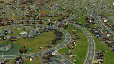
Urban planners are using Cities: Skylines to test and showcase planning ideas, according to an article by parCitypatory written in collaboration with Dennis Gastelum.
While noting that the game is indicative of many of the problems with urban planning in the United States, like car-centric infrastructure and development patterns and a tendency to prioritize investments in already wealthy neighborhoods, for example, the article touts the public engagement tools built into the game as a gateway to understanding the critical component of public engagement.
However, there are some interesting elements of the game that allow you to have an interaction between the player and its simulated citizens. There is Chirper, a Twitter-like dialog bar that allows you to know how citizens are feeling about your recent actions, as well as a measurement of general happiness that helps you guide your decisions.
Still, according to the article, the simulated engagement process is no substitute for the real thing, and planners that want to expand the power of the game to inform planning processes will have to bring in real humans to interact with the models provided by the game's simulation. Numerous examples of planners using the game as an engagement tool follow, including the example shown in the video shared above. The following video shows an example of planners in Stockholm using the game as an engagement tool to plan the Norra Djurgardstaden area of the city, with goals for 12,000 homes and 35,000 workspaces.
The article also notes that Cities: Skylines isn't the only game with the potential to supplement public engagement processes: "Similarly, other games such as Fortnite, Minecraft and UrbanFootprint are used in many cities around the world to develop urban planning projects. Even UN Habitat is using Minecraft to change neighbourhood design with the Block by Block project." Don't forget SimCity, too!
FULL STORY: Designing Cities with Computer Games: Simulating Citizen Participation


How a City Planner Plays SimCity
A gaming video on the popular City Beautiful YouTube channel shows of the Sim City skills of a professional city planner.
The Not-So-Great Lessons of SimCity
A game encountered as a youth has brought many adults to the ranks of professional planning. What, then, is the legacy of the lessons offered by SimCity and its brethren?

Is Twitter Still an Effective Planning Tool?
Twitter has been a daily dose of drama and upheaval ever since Elon Musk offered to pay over $40 billion to buy the social media platform. Media outlets and public transit agencies had been abandoning the social media platform—should planners?

Planetizen Federal Action Tracker
A weekly monitor of how Trump’s orders and actions are impacting planners and planning in America.

Maui's Vacation Rental Debate Turns Ugly
Verbal attacks, misinformation campaigns and fistfights plague a high-stakes debate to convert thousands of vacation rentals into long-term housing.

San Francisco Suspends Traffic Calming Amidst Record Deaths
Citing “a challenging fiscal landscape,” the city will cease the program on the heels of 42 traffic deaths, including 24 pedestrians.

Amtrak Rolls Out New Orleans to Alabama “Mardi Gras” Train
The new service will operate morning and evening departures between Mobile and New Orleans.

The Subversive Car-Free Guide to Trump's Great American Road Trip
Car-free ways to access Chicagoland’s best tourist attractions.

San Antonio and Austin are Fusing Into one Massive Megaregion
The region spanning the two central Texas cities is growing fast, posing challenges for local infrastructure and water supplies.
Urban Design for Planners 1: Software Tools
This six-course series explores essential urban design concepts using open source software and equips planners with the tools they need to participate fully in the urban design process.
Planning for Universal Design
Learn the tools for implementing Universal Design in planning regulations.
Heyer Gruel & Associates PA
JM Goldson LLC
Custer County Colorado
City of Camden Redevelopment Agency
City of Astoria
Transportation Research & Education Center (TREC) at Portland State University
Jefferson Parish Government
Camden Redevelopment Agency
City of Claremont