


Aerial Photography
Friday Eye Candy: 195 Gigapixels of Urban Glory
An incredibly detailed bird's eye view of Shanghai.

New Research Methods Help Nebraska's Water Management Plan
Researchers at the University of Nebraska have been working with the Nebraska Department of Natural Resources to develop best practices for predicting and planning for the future water needs of urban developments.
Friday Eye Candy: Where U.S. Roads Correct the Grid
Anyone who has traveled long country roads is familiar with the moment when a road makes a sharp turn to deviate from a direct path. Such "grid corrections" provide the subject for a photography project by Gerco de Ruijter.
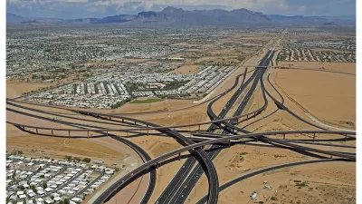
Friday Eye Candy: Freeway Interchanges From Far Above
High quality, high altitude images of that marvel of modern engineering: the freeway interchange.
Friday Eye Candy: Full-Color, HD Videos Taken from Space
For the first time, full-color videos of the earth's surface will be made available to the public, with added options for paying customers. The imagery comes from two cameras on the International Space Station.

Looking for Inspiration? Try a Daily Dose of a Satellite's Perspective
Here's a strange idea that just might work: viewing the planet from afar might offer the perspective necessary to care for and protect our place in the universe.
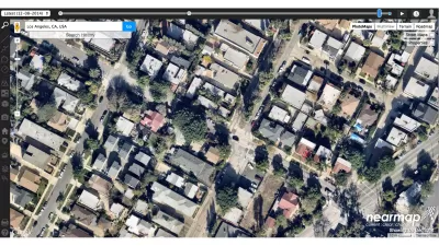
An Aerial Photography Tool for Planners
File under tools for the tool kit: Jarrett Walker of Human Transit shares details about Nearmap, an aerial photography tool that serves as a helpful alternative to Google Earth.
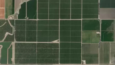
Friday Eye Candy: Stunning Overhead Perspectives on Human Interactions with Land
The “Daily Overview” website provides a compendium of high-altitude, overhead photography from around the world.
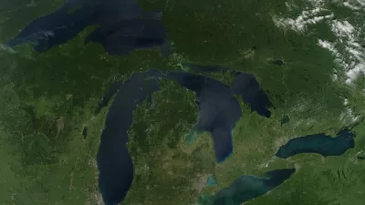
Stunning Photos of Earth From Space
A collection of satellite photos reveals the planet's beauty and vulnerability from threats such as desertification, sprawl, and pollution.

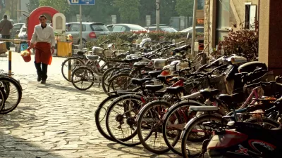
Stunning Images from America's Urban Past
Independence Day is a day to reflect on America's history; and with many of the activities associated with the holiday (parades, fireworks) set on urban stages, it's the perfect occasion to enjoy some amazing images of the country's urban past.
Friday Eye Candy: The World's Oldest Aerial Photo
Ever wonder what downtown Boston looked like on the eve of the Civil War? This photograph taken from a hot air balloon by James Wallace Black is thought to be the oldest aerial photo still in existence. Google Earth eat your heart out.
DIY Aerial Imaging Now a Reality
Ever get frustrated looking for the right aerial image of your project site on Google Earth? Emily Badger has found the solution - a DIY balloon mapping kit developed by cartographer Stewart Long.
Making Art out of America's Interstates
They may not be pretty to drive, but they sure are nice to look at from afar. Kelsey Campbell-Dollaghan profiles the work of aerial photographer Peter Andrew, who captures the beauty in America's Interstate System.
Aerial Photos Show Chicago's Growth
Lawrence Okrent is a Chicago planning and zoning consultant and also a photographer. Recreating a series of aerial photographs from 1985, he shows the remarkable growth of the city over the last 15 years.
Using Balloons for Bird's Eye View of Community
At the GeoDesign conference in San Diego we heard mention of folks at MIT using helium balloons with cameras attached to take aerial pictures. Thinking this was a fabulous idea I decided to find out more and see if this was a technique [...]
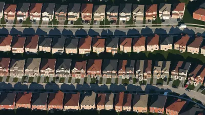
Looking Down on Sprawl
Writing in The New York Times, Geoff Manaugh looks at Christoph Gielen's aerial photography of urban development and sprawl.
Urban Design for Planners 1: Software Tools
This six-course series explores essential urban design concepts using open source software and equips planners with the tools they need to participate fully in the urban design process.
Planning for Universal Design
Learn the tools for implementing Universal Design in planning regulations.
planning NEXT
Appalachian Highlands Housing Partners
Mpact (founded as Rail~Volution)
City of Camden Redevelopment Agency
City of Astoria
City of Portland
City of Laramie


