


Lawrence Okrent is a Chicago planning and zoning consultant and also a photographer. Recreating a series of aerial photographs from 1985, he shows the remarkable growth of the city over the last 15 years.
Okrent's new book, "Chicago From the Sky: A Region Transformed," is full of these comparison aerial photographs. Blair Kamin says the book often reads "as a paean to Chicago's unquenchable appetite for change."
Kamin says that Okrent does not take a position one way or another on whether the growth was good or bad for the city:
"Readers must draw their own conclusions, though the sharp-eyed will surely be able to discern key trends, among them how Daley's love for planting trees has softened once-mean streets."
A photo gallery can be seen over at The Chicago Tribune.


Stunning Images from America's Urban Past
Independence Day is a day to reflect on America's history; and with many of the activities associated with the holiday (parades, fireworks) set on urban stages, it's the perfect occasion to enjoy some amazing images of the country's urban past.

The Subversive Car-Free Guide to Trump's Great American Road Trip
Car-free ways to access Chicagoland’s best tourist attractions.
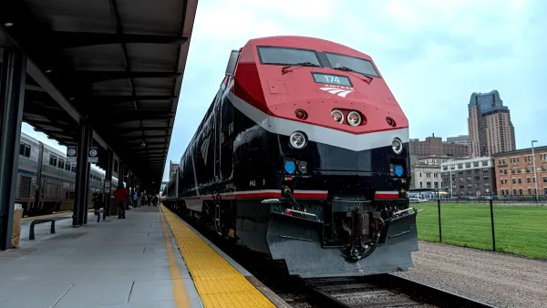
Amtrak’s Borealis Exceeds First Year Ridership Expectations
205,800 passengers have boarded the St. Paul to Chicago line, well above initial MDOT projections.

Planetizen Federal Action Tracker
A weekly monitor of how Trump’s orders and actions are impacting planners and planning in America.

Maui's Vacation Rental Debate Turns Ugly
Verbal attacks, misinformation campaigns and fistfights plague a high-stakes debate to convert thousands of vacation rentals into long-term housing.

San Francisco Suspends Traffic Calming Amidst Record Deaths
Citing “a challenging fiscal landscape,” the city will cease the program on the heels of 42 traffic deaths, including 24 pedestrians.

Amtrak Rolls Out New Orleans to Alabama “Mardi Gras” Train
The new service will operate morning and evening departures between Mobile and New Orleans.

The Subversive Car-Free Guide to Trump's Great American Road Trip
Car-free ways to access Chicagoland’s best tourist attractions.

San Antonio and Austin are Fusing Into one Massive Megaregion
The region spanning the two central Texas cities is growing fast, posing challenges for local infrastructure and water supplies.
Urban Design for Planners 1: Software Tools
This six-course series explores essential urban design concepts using open source software and equips planners with the tools they need to participate fully in the urban design process.
Planning for Universal Design
Learn the tools for implementing Universal Design in planning regulations.
Heyer Gruel & Associates PA
JM Goldson LLC
Custer County Colorado
City of Camden Redevelopment Agency
City of Astoria
Transportation Research & Education Center (TREC) at Portland State University
Jefferson Parish Government
Camden Redevelopment Agency
City of Claremont