


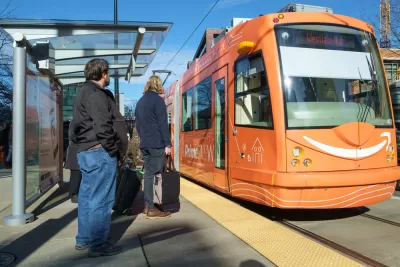
A new streetcar extension would complete Seattle's streetcar network in a particularly busy corner of the city's downtown. The mayor doesn’t seem enthused with the idea, even if riders are already enthused with streetcars.
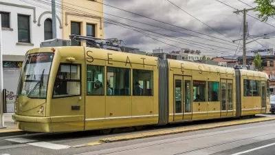
Jon Talton writes a column to lament the failure of the Center City Connector, a 15-block streetcar extension that would complete a streetcar network in several neighborhoods around Downtown Seattle.
"For a city with so much luck, Seattle has done repeated face plants in attempting to build necessary rail transit," writes Talton. "Never miss an opportunity to miss an opportunity. Shoot ourselves in the foot and reload."
This take on Seattle's lack of transit investment might come as a surprise to outsiders, who regularly read of transit success in the city, from increasing bus ridership to increased ridership on waterborne transit to declining solo car commuters. But, Talton cites a significant historical episode to make his case for Seattle as a public transit cautionary tale: "The most notorious mistake was the 1970 failure to pass bonds to build a regional subway system, which would have been 75 percent funded by the federal government."
With the Center City Connector, Talton notes that Mayor Jenny Durkan shelved the project in March (as reported at the time by David Gutman) to study project expenses. According to Talton, the lack of a complete streetcar system would be shame. Unlike other streetcars around the country, Seattle's current system is transporting increasing numbers of users.
"The Center City Connector, which would mostly run along First Avenue from Pioneer Square to meet the South Lake Union line, would be an especially sweet spot for passengers. Among the destinations: Pike Place Market, the Seattle Art Museum, and, nearby, the waterfront and the ferry and cruise terminals," according to Talton.
FULL STORY: Center City streetcar line would complete badly needed transit link

Central City Connector Streetcar Inches Forward in Seattle
In the first signs of life for the beleaguered transit project in over a year, Seattle officials found some of the money they need to proceed with the Central City Connector streetcar project.
Boosters Hope Streetcar Could Breathe New Life into Downtown Seattle
Supporters of a stalled streetcar project say reviving the line would create more transit connections and boost economic development in the area.
Research Casts Doubt on the Economic Development Clout of Streetcar Investments
New research is ambivalent about the potential for streetcar investments to reap promised economic development rewards.

Planetizen Federal Action Tracker
A weekly monitor of how Trump’s orders and actions are impacting planners and planning in America.

Congressman Proposes Bill to Rename DC Metro “Trump Train”
The Make Autorail Great Again Act would withhold federal funding to the system until the Washington Metropolitan Area Transit Authority (WMATA), rebrands as the Washington Metropolitan Authority for Greater Access (WMAGA).

DARTSpace Platform Streamlines Dallas TOD Application Process
The Dallas transit agency hopes a shorter permitting timeline will boost transit-oriented development around rail stations.

Affordable Housing Finance 101
The financial intricacies involved in building affordable housing can be difficult to understand. This explainer breaks down the foundational concepts.

San Francisco's School District Spent $105M To Build Affordable Housing for Teachers — And That's Just the Beginning
SFUSD joins a growing list of school districts using their land holdings to address housing affordability challenges faced by their own employees.

Car-Centric LA Suburb Looks to a Train-Oriented Future
City leaders in Rancho Cucamonga, the future western terminus of the Brightline West rail line to Las Vegas, want to reimagine the city as a transit-oriented, pedestrian-friendly community.
Urban Design for Planners 1: Software Tools
This six-course series explores essential urban design concepts using open source software and equips planners with the tools they need to participate fully in the urban design process.
Planning for Universal Design
Learn the tools for implementing Universal Design in planning regulations.
Municipality of Princeton
Roanoke Valley-Alleghany Regional Commission
City of Mt Shasta
City of Camden Redevelopment Agency
City of Astoria
Transportation Research & Education Center (TREC) at Portland State University
US High Speed Rail Association
City of Camden Redevelopment Agency
Municipality of Princeton (NJ)