


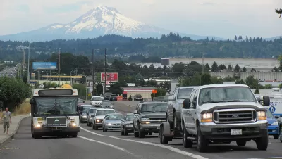
Faced with an uptick in roadway fatalities, Oregon is looking at how to increase safety. But it's concentrating on highways while arterials actually account for the region's most severe crashes.
Over at City Observatory, Joe Cortright has been criticizing plans in Oregon and elsewhere to curb congestion by widening freeways. Here, he points out possibly faulty logic (or mixed priorities) in how Oregon's Department of Transportation is pursuing Vision Zero.
"If we're going to achieve Vision Zero, it really means concentrating our energy and resources on the serious crashes, and not the more numerous, but far less serious ones," Cortright writes. Fatalities on Oregon roads have been on the rise in recent years.
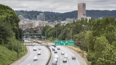
Pointing to a recent ODOT report [pdf] on traffic performance in the Portland region, Cortright says the department's priorities are skewed. "The report makes it clear that ODOT is primarily interested in crashes not because they kill and maim Oregonians, but because they're associated with slower freeway traffic."
More attention should be paid to safety on arterial roadways, Cortright says, than on highways, which are statistically safer in the area. "On average, the region's arterials have five times as many serious crashes per mile traveled as freeways, according to the Metro study, a finding they called 'one of the most conclusive relationships in this study.'" That study, which is several years old, can be found here.
FULL STORY: Dying to widen highways

Environmental Assessment for I-5 Improvement Project in Portland Promises Air, Traffic, Safety Benefits
The environmental assessment for the I-5 Rose Quarter Improvement Project, released on February 15, 2019, promises to be controversial.
Feds Toss the Environmental Assessment for Portland Controversial Freeway Widening Project
It's back to the drawing board for the I-5 Rose Quarter Improvement Project.

Portland and Multnomah County Push for Lower Speed Limits on Bridges
The Portland Bureau of Transportation and Multnomah County agree on a 30 mph speed limit on five downtown bridges, but the state's department of transportation denied the change on two key spans.

Maui's Vacation Rental Debate Turns Ugly
Verbal attacks, misinformation campaigns and fistfights plague a high-stakes debate to convert thousands of vacation rentals into long-term housing.

Planetizen Federal Action Tracker
A weekly monitor of how Trump’s orders and actions are impacting planners and planning in America.

In Urban Planning, AI Prompting Could be the New Design Thinking
Creativity has long been key to great urban design. What if we see AI as our new creative partner?

Pedestrian Deaths Drop, Remain Twice as High as in 2009
Fatalities declined by 4 percent in 2024, but the U.S. is still nowhere close to ‘Vision Zero.’

King County Supportive Housing Program Offers Hope for Unhoused Residents
The county is taking a ‘Housing First’ approach that prioritizes getting people into housing, then offering wraparound supportive services.

Researchers Use AI to Get Clearer Picture of US Housing
Analysts are using artificial intelligence to supercharge their research by allowing them to comb through data faster. Though these AI tools can be error prone, they save time and housing researchers are optimistic about the future.
Urban Design for Planners 1: Software Tools
This six-course series explores essential urban design concepts using open source software and equips planners with the tools they need to participate fully in the urban design process.
Planning for Universal Design
Learn the tools for implementing Universal Design in planning regulations.
planning NEXT
Appalachian Highlands Housing Partners
Mpact (founded as Rail~Volution)
City of Camden Redevelopment Agency
City of Astoria
City of Portland
City of Laramie