


Recent studies find that central Denver is still woefully underserved when it comes to transit accessibility. On the table are streetscape improvements to make life easier for pedestrians and transit riders.
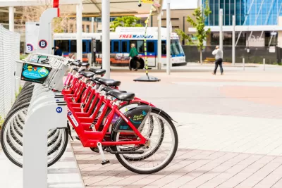
While suburban areas have been increasingly provided for, the city of Denver's transit situation isn't what it should be. "Redundant bus routes and too many stops, and the lack of dedicated transit lanes, results in frustratingly slow service that's more competitive with walking than driving."
The political will is there to make central Denver more transit-friendly. "With the 2017 General Obligation Bond up for a vote this fall, Mayor Michael Hancock has signalled his willingness to devote $370 million to creating transit-friendly streetscapes. Bringing more resources to expanded city transit will likely require additional funding measures after 2017."
Suggested fixes include street-level improvements to aid pedestrians, as well as reworking routes and frequencies. "The Denver Moves transit plan recently completed a citywide transit needs study. The findings weren't surprising: pedestrian access to transit stations is lacking, bus frequency falls off a cliff outside of peak hours, many routes are indirect and illegible, and merely a quarter of bus stops feature basic shelters."
FULL STORY: City of Denver Mobilizes for Better Transit

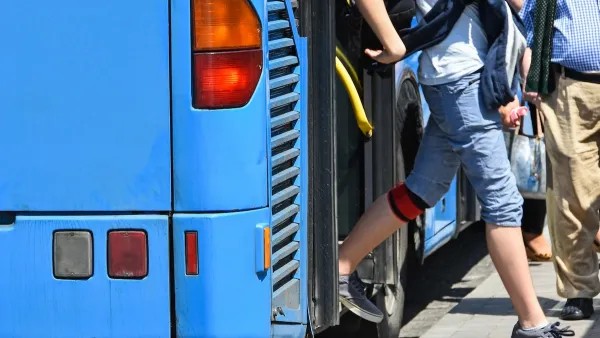
Opinion: Make Buses More Like Sidewalks
Sidewalks are an intuitive, low-cost, and easily accessible mobility tool. Can local buses function in the same way?

Limited Transit Access Stifling Memphis Economy
The city ranks low for transit access to jobs, limiting opportunities for local workers and businesses.

Denver to Shift Sidewalk Repair Work to City, Funded by Property Owners
The city is shifting from a piecemeal approach to sidewalk repairs that charged property owners with doing the work to a more streamlined, city-led process.

Planetizen Federal Action Tracker
A weekly monitor of how Trump’s orders and actions are impacting planners and planning in America.

Restaurant Patios Were a Pandemic Win — Why Were They so Hard to Keep?
Social distancing requirements and changes in travel patterns prompted cities to pilot new uses for street and sidewalk space. Then it got complicated.

Map: Where Senate Republicans Want to Sell Your Public Lands
For public land advocates, the Senate Republicans’ proposal to sell millions of acres of public land in the West is “the biggest fight of their careers.”

Orange County, Florida Adopts Largest US “Sprawl Repair” Code
The ‘Orange Code’ seeks to rectify decades of sprawl-inducing, car-oriented development.

Maui's Vacation Rental Debate Turns Ugly
Verbal attacks, misinformation campaigns and fistfights plague a high-stakes debate to convert thousands of vacation rentals into long-term housing.

San Francisco Suspends Traffic Calming Amidst Record Deaths
Citing “a challenging fiscal landscape,” the city will cease the program on the heels of 42 traffic deaths, including 24 pedestrians.
Urban Design for Planners 1: Software Tools
This six-course series explores essential urban design concepts using open source software and equips planners with the tools they need to participate fully in the urban design process.
Planning for Universal Design
Learn the tools for implementing Universal Design in planning regulations.
Heyer Gruel & Associates PA
JM Goldson LLC
Custer County Colorado
City of Camden Redevelopment Agency
City of Astoria
Transportation Research & Education Center (TREC) at Portland State University
Camden Redevelopment Agency
City of Claremont
Municipality of Princeton (NJ)