


Fans of transit maps will have to watch out for the new map of BaltimoreLink.
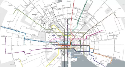
"Baltimore will soon be the latest American city to overhaul its bus network in an attempt to jumpstart ridership," reports Peter Dovak. "The plan, known as 'BaltimoreLink'," will go into effect on June 18. So far the best part is a really, really cool new map."
The Baltimore bus system reorganization follows the famous example of Houston, which reorganized its bus syetm in 2015 and is now one of the few systems in the country attracting on increased numbers of riders in recent years.
"The core of the BaltimoreLink plan is a dozen color-coded, high-frequency routes known as CityLink lines," explains Dovak. "They'll run 24 hours a day along Baltimore's downtown grid and then radiate out of the city in every direction, complimented by less frequent local and express lines."
A good portion of the article is devoted to the design of the Baltimore Link map, which a radial structure that allows for both a striking appearance and legible detail. A quick mention of the system re-structure's political origins—as a replacement for the aborted Red Line Subway project—is also included in the article.

FULL STORY: The map for Baltimore’s new bus system is positively radiant

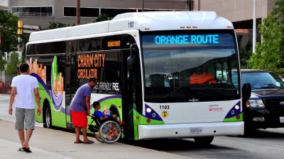
One-Year Later: Evaluating Baltimore's Overhauled Bus System
The $135 million BaltimoreLink bus system redesign launched in June 2017.
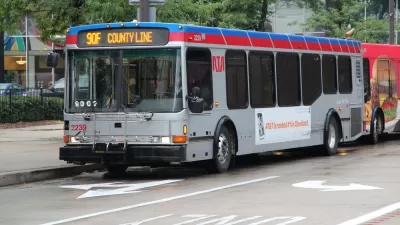
Bus System Redesign Coming to the Cleveland Region
The Greater Cleveland Regional Transit Authority (RTA) revealed a draft system redesign this week.
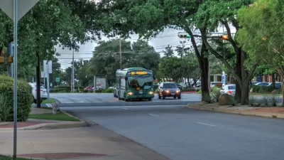
Bus System Redesign Boosts Ridership in Austin
Over a year after Capital Metro in Austin overhauled its bus system design, the system is bucking national trends and achieving growth in its ridership numbers.

Planetizen Federal Action Tracker
A weekly monitor of how Trump’s orders and actions are impacting planners and planning in America.

Restaurant Patios Were a Pandemic Win — Why Were They so Hard to Keep?
Social distancing requirements and changes in travel patterns prompted cities to pilot new uses for street and sidewalk space. Then it got complicated.

Map: Where Senate Republicans Want to Sell Your Public Lands
For public land advocates, the Senate Republicans’ proposal to sell millions of acres of public land in the West is “the biggest fight of their careers.”

Maui's Vacation Rental Debate Turns Ugly
Verbal attacks, misinformation campaigns and fistfights plague a high-stakes debate to convert thousands of vacation rentals into long-term housing.

San Francisco Suspends Traffic Calming Amidst Record Deaths
Citing “a challenging fiscal landscape,” the city will cease the program on the heels of 42 traffic deaths, including 24 pedestrians.

California Homeless Arrests, Citations Spike After Ruling
An investigation reveals that anti-homeless actions increased up to 500% after Grants Pass v. Johnson — even in cities claiming no policy change.
Urban Design for Planners 1: Software Tools
This six-course series explores essential urban design concepts using open source software and equips planners with the tools they need to participate fully in the urban design process.
Planning for Universal Design
Learn the tools for implementing Universal Design in planning regulations.
Heyer Gruel & Associates PA
JM Goldson LLC
Custer County Colorado
City of Camden Redevelopment Agency
City of Astoria
Transportation Research & Education Center (TREC) at Portland State University
Camden Redevelopment Agency
City of Claremont
Municipality of Princeton (NJ)