


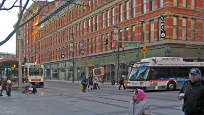
Denver and Austin were finalists in the competition. Since then, they've found ways to implement their ideas.
78 cities applied to the Obama Administration's Smart Cities Challenge last year, proposing innovative uses of data, apps, and technology to improve transportation systems. Though Columbus, Ohio was the ultimate winner of $50 million in private and DOT dollars, Governing reports that many of the other cities are also moving forward on their ideas.
In Denver and Austin, just putting the submissions together "energized" city staff and fostered collaboration among people "who normally don't work side by side"—garnering a combination of other federal grants and public-private partnerships to support their plans. Austin is now creating a new regional center where "transportation officials from the city, state, toll roads, and transit agencies can coordinate their day-to-day operations with each other."
That kind of integration was an organizing principle in the Smart Cities Challenge, and for good reason: Coordination behind the scenes can lead to improved traffic and quicker solutions to problems on the ground.
“Ultimately, I don’t care if it’s a state engineer that hits the button that automatically gets more green time on city arterials, or if it’s a city traffic engineering saying, ‘There’s an accident over there on the freeway, so I better put up information signs up and down the freeway so that people know what to expect,” [Austin Transportation's Robert Spillar] said. “That seems simple, but I will tell you it’s like trying to jump over the Grand Canyon.”
FULL STORY: These Places Lost the Smart Cities Challenge. But They Say They Ended Up Ahead.

7 'Smart Cities Challenge' Proposals
The Washington Post details each of the seven proposals competing for $40 million in the U.S. Department of Transportation's Smart Cities Challenge.
Austin Scores Highest on Pandemic Recovery; Bay Area and Baltimore Lowest
The Bay Area Council and CBRE created an economic tracker to measure how well the nation's 25 largest metropolitan areas have recovered from the public health restrictions imposed on their regions at the onset of the pandemic.
Removal Over Reconstruction: Rectifying Crumbling U.S. Highways
Successful urban highway deconstruction projects have swapped highways for boulevards and saw economic, public health, and urban design benefits. Will more cities opt for highway removal programs over reconstruction?

Planetizen Federal Action Tracker
A weekly monitor of how Trump’s orders and actions are impacting planners and planning in America.

San Francisco's School District Spent $105M To Build Affordable Housing for Teachers — And That's Just the Beginning
SFUSD joins a growing list of school districts using their land holdings to address housing affordability challenges faced by their own employees.

The Tiny, Adorable $7,000 Car Turning Japan Onto EVs
The single seat Mibot charges from a regular plug as quickly as an iPad, and is about half the price of an average EV.

Seattle's Plan for Adopting Driverless Cars
Equity, safety, accessibility and affordability are front of mind as the city prepares for robotaxis and other autonomous vehicles.

As Trump Phases Out FEMA, Is It Time to Flee the Floodplains?
With less federal funding available for disaster relief efforts, the need to relocate at-risk communities is more urgent than ever.

With Protected Lanes, 460% More People Commute by Bike
For those needing more ammo, more data proving what we already knew is here.
Urban Design for Planners 1: Software Tools
This six-course series explores essential urban design concepts using open source software and equips planners with the tools they need to participate fully in the urban design process.
Planning for Universal Design
Learn the tools for implementing Universal Design in planning regulations.
Smith Gee Studio
City of Charlotte
City of Camden Redevelopment Agency
City of Astoria
Transportation Research & Education Center (TREC) at Portland State University
US High Speed Rail Association
City of Camden Redevelopment Agency
Municipality of Princeton (NJ)