


The NYC Transit Explorer from Sidewalk Labs shows how much transit service New Yorkers stand to lose when the L Train shuts down for 18 months.
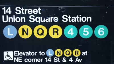
Dan Vanderkam writes a post to explain how Sidewalk Labs worked with the New York-based advocacy group Transportation Alternatives to create an interactive tool to illustrate how the looming shutdown of the L Train in New York will affect residents and commuters.
The tool is a map demo we’re calling the NYC Transit Explorer. It’s built on top of a transit router that uses the latest GTFS feeds for all MTA bus and subway lines, as well as the Staten Island ferry, to determine travel times and routes throughout the five boroughs. Traditional navigation routers direct people from Point A to Point B (call it one-to-one); our router adds the ability to show people how long it would take to get anywhere in the city via transit from a given origin (one-to-many).
After explaining the tool, Vanderkam then walks through step-by-step examples to show how the L Train closure will affect transit trips between Brooklyn and Manhattan—in terms of general accessibility and along specific routes. The post concludes with a call to action developers and civic hackers for help improving the tool.
FULL STORY: New map demo: How the L train shutdown will impact your commute


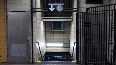
First Weekend of L Train Slowdown Could Have Been Worse
The long awaited repair work on the L Train between Brooklyn and Manhattan launched over the weekend.
Breaking: Gov. Cuomo Cancels L Train Closure
Surprise, shocking news from New York City, as Governor Andrew Cuomo steps in at the 11th hour to change course on the highly anticipated (and dreaded) L Train closure scheduled to begin later this year.
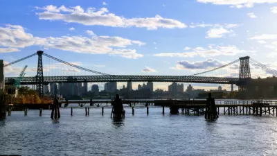
Single-Occupant Vehicles Banned on Williamsburg Bridge During L Train Closure
Solo commuters crossing from Brooklyn to Manhattan on the Williamsburg Bridge are in for a rude awakening on April 27 when the L Train closes. To accommodate more buses and bikes on the 115-year old bridge, cars will need at least 3 people.

Planetizen Federal Action Tracker
A weekly monitor of how Trump’s orders and actions are impacting planners and planning in America.

San Francisco's School District Spent $105M To Build Affordable Housing for Teachers — And That's Just the Beginning
SFUSD joins a growing list of school districts using their land holdings to address housing affordability challenges faced by their own employees.

The Tiny, Adorable $7,000 Car Turning Japan Onto EVs
The single seat Mibot charges from a regular plug as quickly as an iPad, and is about half the price of an average EV.

Seattle's Plan for Adopting Driverless Cars
Equity, safety, accessibility and affordability are front of mind as the city prepares for robotaxis and other autonomous vehicles.

As Trump Phases Out FEMA, Is It Time to Flee the Floodplains?
With less federal funding available for disaster relief efforts, the need to relocate at-risk communities is more urgent than ever.

With Protected Lanes, 460% More People Commute by Bike
For those needing more ammo, more data proving what we already knew is here.
Urban Design for Planners 1: Software Tools
This six-course series explores essential urban design concepts using open source software and equips planners with the tools they need to participate fully in the urban design process.
Planning for Universal Design
Learn the tools for implementing Universal Design in planning regulations.
Smith Gee Studio
City of Charlotte
City of Camden Redevelopment Agency
City of Astoria
Transportation Research & Education Center (TREC) at Portland State University
US High Speed Rail Association
City of Camden Redevelopment Agency
Municipality of Princeton (NJ)