


A smart city pilot project, already in place at three locations in Chicago and on the way to two more, deploys sophisticated data gathering technology to measure the simple act of rainwater running downhill. Better green infrastructure will follow.
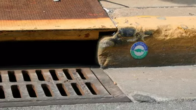
Sean Thornton reports: "By combining sensors and cloud computing, a new pilot project in Chicago provides an innovative solution for what can be an everyday urban problem: rainwater."
"Launched by City Digital, a smart city incubator located within the consortium of public, private, and higher education entities that is UI Labs, the Smart Green Infrastructure Monitoring (SGIM) project aims to provide cities with a tool to reduce urban flooding and prevent millions of dollars in subsequent property damage," adds Thornton.
The sensors deployed at the SGIM sites hope to collect data that will help planners and engineers better plan and manage green infrastructure.
For example, Argyle Street, the city's first shared street, boasting some of the city's newest permeable paving, provides one of the test sites for the SGIM project. "Underneath Argyle Street, City Digital and its partners have installed sensors to collect stormwater runoff data. These sensors can record, among other things, precipitation amounts, humidity levels, soil moisture measurements, air pressure levels, and chemical absorption rates," reports Thornton.
SGIM's data is expected to be publicly available on the city's data portal in 2017. The article includes more detail about City Digital, the SGIM project in particular, and stormwater infrastructure more generally.
FULL STORY: How a Smart City Tackles Rainfall

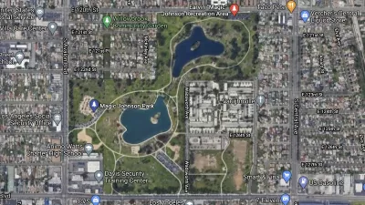
South Los Angeles Park Offers Hidden Benefits
Not only does the redevelopment of a large section of Earvin Magic Johnson Park in Willowbrook offer much needed green space and new amenities, it also helps to conserve water and improve water quality.

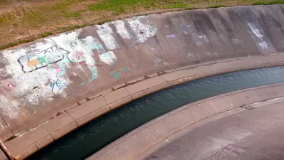
FYI about GSI: The Recipe for Green Stormwater Infrastructure Success
New research highlights some of the ways planners can increase the social benefits and public acceptance of green stormwater infrastructure.
Stormwater Credits Provide Incentives for Green Infrastructure
Most harmful stormwater originates on private property, and public agencies are looking for ways to entice property owners to implement more effective infrastructure.

Planetizen Federal Action Tracker
A weekly monitor of how Trump’s orders and actions are impacting planners and planning in America.

Chicago’s Ghost Rails
Just beneath the surface of the modern city lie the remnants of its expansive early 20th-century streetcar system.

San Antonio and Austin are Fusing Into one Massive Megaregion
The region spanning the two central Texas cities is growing fast, posing challenges for local infrastructure and water supplies.

Since Zion's Shuttles Went Electric “The Smog is Gone”
Visitors to Zion National Park can enjoy the canyon via the nation’s first fully electric park shuttle system.

Trump Distributing DOT Safety Funds at 1/10 Rate of Biden
Funds for Safe Streets and other transportation safety and equity programs are being held up by administrative reviews and conflicts with the Trump administration’s priorities.

German Cities Subsidize Taxis for Women Amid Wave of Violence
Free or low-cost taxi rides can help women navigate cities more safely, but critics say the programs don't address the root causes of violence against women.
Urban Design for Planners 1: Software Tools
This six-course series explores essential urban design concepts using open source software and equips planners with the tools they need to participate fully in the urban design process.
Planning for Universal Design
Learn the tools for implementing Universal Design in planning regulations.
planning NEXT
Appalachian Highlands Housing Partners
Mpact (founded as Rail~Volution)
City of Camden Redevelopment Agency
City of Astoria
City of Portland
City of Laramie