


Indianapolis' I-65/I-70 inner loop, now 40 years old, made a big impact on the city.
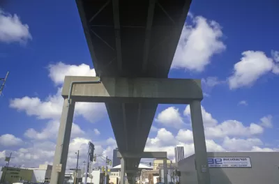
In a story for Indianapolis Monthly, Brian D. Smith reports that the I-65/I-70 inner loop is, for better or worse, one of the most important pieces of infrastructure Indianapolis ever built.
Many of the improvements and key features of the city would never have been built if the expressway hadn't been there. Smith writes, "Without this key piece of infrastructure, there might never have been a Lucas Oil Stadium."
There have, however, been problems associated with the loop. "Just three days after the ribbon-cutting, a Noblesville truck driver lost his life near the northeast interchange on a sharp bend where three other semis had already flipped." This stretch of road known locally as "Dead Man's Curve," was eventually the subject of a $500,000 renovation for safety. Other issues were the people moved and neighborhoods disrupted, "The project displaced a total of 17,000 residents, including 6,000 from Fountain Square (one-fourth of the population)."
Today the I-65/I-70 inner loop is a defining feature of Indianapolis, for better and worse.
FULL STORY: Fruits of the Loop: An Unsung Milestone in Indy’s Downtown Development

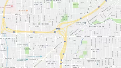
State Plan to Expand a Downtown Indianapolis Intersection Meets Local Resistance
Local urbanists are opposing a plan to greatly expand a freeway intersection in neighborhoods adjacent to Downtown Indianapolis.
Indianapolis Advances Plans to Expand and Connect Citywide Greenway Network
Indianapolis is developing a new Greenways Strategic Implementation Plan to expand, connect, and modernize its trail system, aiming for over 250 miles of greenways that support sustainability, mobility, and community well-being.

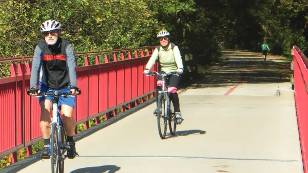
New Indianapolis Bridge Prioritizes Walking, Biking
Over half the surface of the Fall Creek Bridge is devoted to walking and biking paths.

Planetizen Federal Action Tracker
A weekly monitor of how Trump’s orders and actions are impacting planners and planning in America.

Map: Where Senate Republicans Want to Sell Your Public Lands
For public land advocates, the Senate Republicans’ proposal to sell millions of acres of public land in the West is “the biggest fight of their careers.”

Restaurant Patios Were a Pandemic Win — Why Were They so Hard to Keep?
Social distancing requirements and changes in travel patterns prompted cities to pilot new uses for street and sidewalk space. Then it got complicated.

Platform Pilsner: Vancouver Transit Agency Releases... a Beer?
TransLink will receive a portion of every sale of the four-pack.

Toronto Weighs Cheaper Transit, Parking Hikes for Major Events
Special event rates would take effect during large festivals, sports games and concerts to ‘discourage driving, manage congestion and free up space for transit.”

Berlin to Consider Car-Free Zone Larger Than Manhattan
The area bound by the 22-mile Ringbahn would still allow 12 uses of a private automobile per year per person, and several other exemptions.
Urban Design for Planners 1: Software Tools
This six-course series explores essential urban design concepts using open source software and equips planners with the tools they need to participate fully in the urban design process.
Planning for Universal Design
Learn the tools for implementing Universal Design in planning regulations.
Heyer Gruel & Associates PA
JM Goldson LLC
Custer County Colorado
City of Camden Redevelopment Agency
City of Astoria
Transportation Research & Education Center (TREC) at Portland State University
Camden Redevelopment Agency
City of Claremont
Municipality of Princeton (NJ)