


Indianapolis is developing a new Greenways Strategic Implementation Plan to expand, connect, and modernize its trail system, aiming for over 250 miles of greenways that support sustainability, mobility, and community well-being.

Indianapolis is advancing a major update to its greenway system through the Greenways Strategic Implementation Plan, led by the Department of Public Works (Indy DPW). Building on the 2014 Full Circle Master Plan, the new initiative aims to improve trail connectivity, enhance sustainability, and support economic development. As reported by Hanna Rauworth, the vision includes expanding the city’s greenway network to over 250 miles, creating a more integrated and resilient urban environment for all residents.
Key components of the plan include updating zoning codes to support trail-oriented development, identifying funding strategies, standardizing maintenance protocols, and modernizing design standards. The initiative will also address trail gaps, expand infrastructure, and develop a long-term governance structure for planning and operations. By emphasizing equitable access and environmental integration, the plan seeks to promote public health and neighborhood vitality.
The Greenways Strategic Implementation Plan began in July 2024 and is scheduled for completion by the end of 2025. By 2028, Marion County is expected to offer over 120 miles of greenways, enhancing connections between trails, neighborhoods, and transportation systems. This effort ensures that Indianapolis continues to grow a robust, inclusive, and future-ready trail network for generations to come.
FULL STORY: Indy Greenways: New plan aims to expand and connect trail system


Knoxville Dedicates $1M to New Greenway
The proposed greenway would run along North Broadway and connect to 125 miles of existing trails.

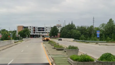
New Indianapolis Bridge Prioritizes Walking, Biking
Over half the surface of the Fall Creek Bridge is devoted to walking and biking paths.
Indy Neighborhood Group Builds Temporary Multi-Use Path
Community members, aided in part by funding from the city, repurposed a vehicle lane to create a protected bike and pedestrian path for the summer season.

Planetizen Federal Action Tracker
A weekly monitor of how Trump’s orders and actions are impacting planners and planning in America.

Maui's Vacation Rental Debate Turns Ugly
Verbal attacks, misinformation campaigns and fistfights plague a high-stakes debate to convert thousands of vacation rentals into long-term housing.

San Francisco Suspends Traffic Calming Amidst Record Deaths
Citing “a challenging fiscal landscape,” the city will cease the program on the heels of 42 traffic deaths, including 24 pedestrians.

Defunct Pittsburgh Power Plant to Become Residential Tower
A decommissioned steam heat plant will be redeveloped into almost 100 affordable housing units.

Trump Prompts Restructuring of Transportation Research Board in “Unprecedented Overreach”
The TRB has eliminated more than half of its committees including those focused on climate, equity, and cities.

Amtrak Rolls Out New Orleans to Alabama “Mardi Gras” Train
The new service will operate morning and evening departures between Mobile and New Orleans.
Urban Design for Planners 1: Software Tools
This six-course series explores essential urban design concepts using open source software and equips planners with the tools they need to participate fully in the urban design process.
Planning for Universal Design
Learn the tools for implementing Universal Design in planning regulations.
Heyer Gruel & Associates PA
JM Goldson LLC
Custer County Colorado
City of Camden Redevelopment Agency
City of Astoria
Transportation Research & Education Center (TREC) at Portland State University
Jefferson Parish Government
Camden Redevelopment Agency
City of Claremont