


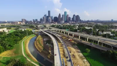
Local and regional transportation planners responded skeptically to data from the Texas Department of Transportation showing Texans driving less.

"According to Texas DOT’s data, the average Texan is driving less every day, and Dallas, Tarrant, and Harris counties saw a decline in total driving mileage, even though they added millions of people," according to an article by Jay Blazek Crossley to summarize revelations made in earlier coverage.
The current article digs deeper into the implications of the data for growth in Texas. First, however, Crossley considers the question of whether the data can even be trusted. Count Alan Clark, transportation planning director of the Houston-Galveston Area Council (H-GAC), among those who believes TxDOT's data to be erroneous.
Clark believes that TXDOT traffic data does not accurately reflect how much people are driving in his region, and he’s worried that TXDOT will use this possibly flawed data to shortchange Houston out of several billion dollars in transportation funds that will be spent elsewhere in the state.
According to Crossley, Clark is not alone in his reluctance to accept the idea that Texas residents have drastically changed their travel habits. Meanwhile, how the state plans for its future, with new funding enabled by Prop 7, as approved by Texas voters in November 2015.
FULL STORY: Is Something Wrong With TXDOT’s Data on Driving?

Rising Costs Threaten TxDOT’s $85 Billion Highway-Building Plans
Texas Transportation Commissioners must have a hangover—backing off its highway building ambitions just a few months after approving the $85 billion Unified Transportation Plan in August 2022.
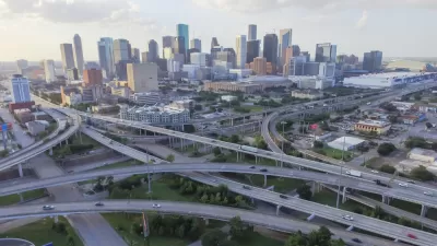
TxDOT Approves I-45 Widening Despite Local Opposition
Despite every manner of local opposition, the Texas Department of Transportation is pushing forward with a plan to widen Interstate 45 north of the city of Houston, demolishing and displacing thousands of homes, businesses, and community facilities.

Austin’s Vision for I-35 Cap Parks Takes Final Shape
The city’s plan includes parks, entertainment pavilions, commercial space, sports fields, and other facilities over 30 acres of deck parks spanning a sunken Interstate 35.

Planetizen Federal Action Tracker
A weekly monitor of how Trump’s orders and actions are impacting planners and planning in America.

Congressman Proposes Bill to Rename DC Metro “Trump Train”
The Make Autorail Great Again Act would withhold federal funding to the system until the Washington Metropolitan Area Transit Authority (WMATA), rebrands as the Washington Metropolitan Authority for Greater Access (WMAGA).

DARTSpace Platform Streamlines Dallas TOD Application Process
The Dallas transit agency hopes a shorter permitting timeline will boost transit-oriented development around rail stations.

San Francisco's School District Spent $105M To Build Affordable Housing for Teachers — And That's Just the Beginning
SFUSD joins a growing list of school districts using their land holdings to address housing affordability challenges faced by their own employees.

Car-Centric LA Suburb Looks to a Train-Oriented Future
City leaders in Rancho Cucamonga, the future western terminus of the Brightline West rail line to Las Vegas, want to reimagine the city as a transit-oriented, pedestrian-friendly community.

New Alaska Bitcoin Mine Would Burn as Much Energy as the State’s Largest Coal Plant
Fueled by “stranded” natural gas, the startup hopes to become the largest in the US, and to make Alaska an industry center.
Urban Design for Planners 1: Software Tools
This six-course series explores essential urban design concepts using open source software and equips planners with the tools they need to participate fully in the urban design process.
Planning for Universal Design
Learn the tools for implementing Universal Design in planning regulations.
Municipality of Princeton
Roanoke Valley-Alleghany Regional Commission
City of Mt Shasta
City of Camden Redevelopment Agency
City of Astoria
Transportation Research & Education Center (TREC) at Portland State University
US High Speed Rail Association
City of Camden Redevelopment Agency
Municipality of Princeton (NJ)