The city’s plan includes parks, entertainment pavilions, commercial space, sports fields, and other facilities over 30 acres of deck parks spanning a sunken Interstate 35.


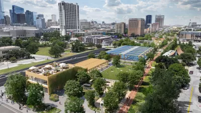
Newly revealed plans show Austin’s finalized vision for capping Interstate 35 after the Texas Department of Transportation lowers the main lanes below street level to accommodate deck parks.
Nathan Bernier describes the proposal, which includes a series of ‘caps and stitches,’ for KUT News. “Caps are more than 300 feet wide, and require advanced ventilation and fire suppression technology for the lanes below. Stitches are essentially caps that are less than 300 feet wide and don't require as much equipment.”
But don’t expect to walk around on top of I-35 anytime soon: “While the first cap could open as soon as 2032, a child born today would have graduated college by the time the plans depicted below are fully constructed,” Bernier notes. (See the source article for images.) Funding for the full project also remains unclear, although it has received some federal grants.
Bernier provides a walkthrough of the plans, outlining the key elements of each portion of the project. “Austin has to prove to TxDOT that it's serious about the capping project. The city must pay the state $19 million by the end of the year to finish engineering designs for the base caps. Local officials must also present TxDOT with a funding plan that shows how the city will pay for everything.”
Read the full story: Austin reveals most detailed plans yet for parks over I-35


Austin Officials Pump the Brakes on I-35 ‘Cap & Stitch’ Project
The city approved a plan to build cap parks over parts of I-35 less than a year ago.

Austin in Race Against Time to Secure Freeway Cap Funding
With a major freeway expansion project looming, the Texas capital is seeking federal funding to build several freeway ‘decks’ downtown.
Letter Reveals Changes to I-35 Expansion Plan in Austin
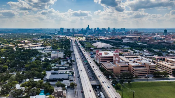
In addition to new HOV lanes and a proposed boardwalk, TxDOT agreed to engineer the freeway for caps in some areas, but the city would have to fund their construction.

Planetizen Federal Action Tracker
A weekly monitor of how Trump’s orders and actions are impacting planners and planning in America.

California plans to bury El Niño’s downpour
If the state plays its cards right, it may be able to store a billion acre-feet of El Niño’s water in aquifers.

Chicago breaks ground on $3 billion megadevelopment
The new neighborhood, titled Foundry Park, will one day host 3,700 residences.

California High-Speed Rail Authority CEO resigns after $600,000 scandal
Under Ian Choudri, the authority used taxpayer dollars to fund first class flights and trips to nightclubs.

Want to study the Missouri River? Soon, you may need unanimous approval from 10 states
Legislation would require 10 governors’ permission to study or build projects moving water outside the basin.

Desperate measures: Advocates weigh draining Lake Powell to fill Colorado River
Draining the reservoir could reduce evaporation losses by a couple hundred thousand acre-feet.

FREE Course: Walkable City 1: Why Walkability?
After describing his path towards focusing on walkability as the essence of good planning, Jeff Speck marches through his five principal reasons for making more walkable places.
Reinventing Malls: Planning Alchemy—Turning Gray Fields Into Gold
The course focuses on the opportunities and imperatives that shape reinvention of mall sites.

City of Rosemead
Rutgers University, Edward J. Bloustein School of Planning and Public Policy
One Hundred Miles
Hunter College, City University of New York (CUNY)
The Architects Foundation
University of Cincinnati Online
City of Cambridge
Montrose County
The Pocatello Development Authority