


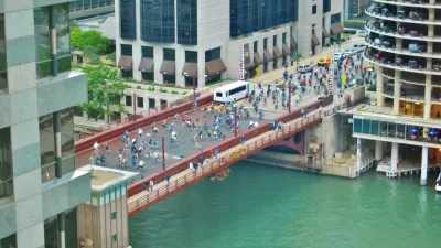
The shared street concept is being tested in Chicago, with goals of spurring economic development, allowing new and flexible use of public spaces, and increasing pedestrian safety.
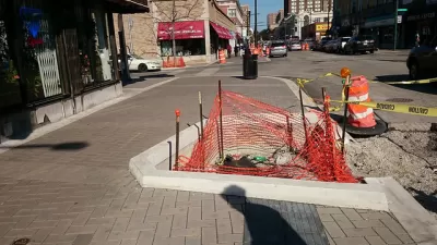
A three-block stretch of Argyle Street in Uptown that was transformed into Chicago's first 'shared street' has created confusion among drivers and garnered mixed reviews from local business owners and pedestrians," according to Leonor Vivanco.
The $3.4 million project launched the shared street in August of this year, after the city's Department of Transportation rolled out the proposed project at the end of 2014.
"Asphalt streets and concrete sidewalks were swapped out for colored pavers on the shared street, which is dotted with Vietnamese restaurants, Asian grocery stores, flower shops and a few empty storefronts — as well as the CTA's Argyle Red Line stop, which received $10 million in improvements in 2012," explains Vivanco, who also notes that the project still has additional changes scheduled.
The article goes into detail about the work that has been done so far, the lessons all involved are gathering as work continues, and the experience on Argyle Street in this interim phase of the experiment.
FULL STORY: 'Shared street' on Argyle is off to bumpy start

Chicago's First Shared Street Planned for Uptown's Argyle Street
Following one failed attempt at a similar plan, a popular neighborhood for shopping will soon become a shared street project. The effort is part of a trend in Chicago looking for ways to transform streets into pedestrian friendly destinations.

Details on Chicago's First Shared Street
Planners are crafting the details of Chicago's first shared street, where pedestrians will rule.
Chicago Dismantles Leland 'Slow Street' Three Months Early
Citing neighborhood concerns, the city is ending the Slow Street program on Leland Street as more parks and beaches reopen, but advocates want to see more permanent traffic calming measures.

Planetizen Federal Action Tracker
A weekly monitor of how Trump’s orders and actions are impacting planners and planning in America.

Chicago’s Ghost Rails
Just beneath the surface of the modern city lie the remnants of its expansive early 20th-century streetcar system.

San Antonio and Austin are Fusing Into one Massive Megaregion
The region spanning the two central Texas cities is growing fast, posing challenges for local infrastructure and water supplies.

Since Zion's Shuttles Went Electric “The Smog is Gone”
Visitors to Zion National Park can enjoy the canyon via the nation’s first fully electric park shuttle system.

Trump Distributing DOT Safety Funds at 1/10 Rate of Biden
Funds for Safe Streets and other transportation safety and equity programs are being held up by administrative reviews and conflicts with the Trump administration’s priorities.

German Cities Subsidize Taxis for Women Amid Wave of Violence
Free or low-cost taxi rides can help women navigate cities more safely, but critics say the programs don't address the root causes of violence against women.
Urban Design for Planners 1: Software Tools
This six-course series explores essential urban design concepts using open source software and equips planners with the tools they need to participate fully in the urban design process.
Planning for Universal Design
Learn the tools for implementing Universal Design in planning regulations.
planning NEXT
Appalachian Highlands Housing Partners
Mpact (founded as Rail~Volution)
City of Camden Redevelopment Agency
City of Astoria
City of Portland
City of Laramie