


Citing neighborhood concerns, the city is ending the Slow Street program on Leland Street as more parks and beaches reopen, but advocates want to see more permanent traffic calming measures.
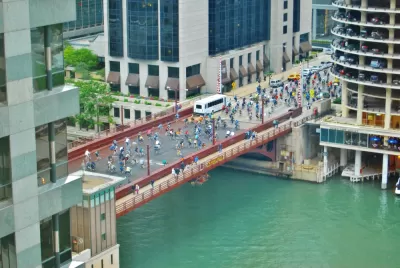
During the pandemic, Chicago's Leland Street became a 'Slow Street,' letting residents use the space for walking, biking, and other active recreation and transportation. As John Greenfield reports, last November, the city dismantled the traffic calming infrastructure for snow plowing season, bringing it back in the spring. But "this year all of the traffic barrels and barricades were removed right after Labor Day, about three months earlier than last year. That’s despite the fact that it’s currently absolutely perfect for walking, jogging, and biking on streets where active transportation and recreation is made safer by banning motorized through traffic."
According to 46th Ward chief of staff Tressa Feher, "comments on a community survey and on Facebook indicated that 'people really like the idea of slowing [drivers] down, but there were problems with drivers not knowing where to go and the barrels getting moved around.' She went on, '[w]e want to talk to CDOT about other ways to calm traffic. If we can get better, more permanent infrastructure, I think people would really like that.'"
Although the street saw a 350 percent increase in foot traffic in 2020 during the Slow Street pilot, Alderman Matt Martin (47th) says "[t]his year, however, did not see as significant a use by pedestrians – likely due to the end of the Stay At Home order and the reopening of the lakefront, parks, and playgrounds." But advocates argue the traffic calming measures still benefit the community by encouraging bicycling and reducing car traffic.
CDOT plans to expand bike infrastructure in other parts of the city, such as the Leland Neighborhood Greenway, slated to be installed next year. "That facility will include contraflow bike lanes that will allow cycling in both directions, plus sidewalk bump-outs to shorten crossing distances, bike-friendly speed bumps, and raised crosswalks."
FULL STORY: Despite 85% increase in cycling on Leland, Slow Street was taken down 3 months early

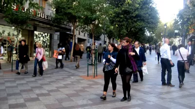
Pedestrian Malls in the 21st Century
The successes and failures of past pedestrian malls can inform the future of pandemic-induced "open streets" programs.
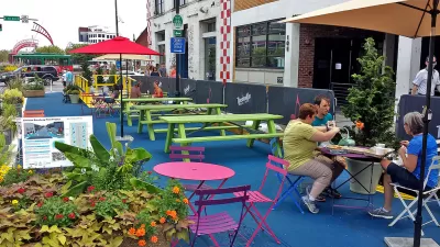
Op-Ed: Don't Reverse the Progress Made by 'Pandemic Streets'
In many cities, the public realm saw a drastic shift towards pedestrian-oriented infrastructure. The L.A. Times editorial board argues we should keep it that way.
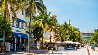
Miami Beach to Reopen Ocean Drive to Cars
The famous cruising strip was off-limits to cars during the pandemic. Now, the city is letting vehicles return with some pedestrian-oriented compromises.

Planetizen Federal Action Tracker
A weekly monitor of how Trump’s orders and actions are impacting planners and planning in America.

Maui's Vacation Rental Debate Turns Ugly
Verbal attacks, misinformation campaigns and fistfights plague a high-stakes debate to convert thousands of vacation rentals into long-term housing.

Cuomo Is the Candidate of Both NIMBYs and Developers. What Gives?
In the New York City mayoral race, odd bedfellows align to preserve the housing status quo.

The Subversive Car-Free Guide to Trump's Great American Road Trip
Car-free ways to access Chicagoland’s best tourist attractions.

San Antonio and Austin are Fusing Into one Massive Megaregion
The region spanning the two central Texas cities is growing fast, posing challenges for local infrastructure and water supplies.

Charlottesville Temporarily Has No Zoning Code
A judge ordered the Virginia city to throw out its newly revised zoning code, leaving permitting for new development in legal limbo.
Urban Design for Planners 1: Software Tools
This six-course series explores essential urban design concepts using open source software and equips planners with the tools they need to participate fully in the urban design process.
Planning for Universal Design
Learn the tools for implementing Universal Design in planning regulations.
Heyer Gruel & Associates PA
JM Goldson LLC
Custer County Colorado
City of Camden Redevelopment Agency
City of Astoria
Transportation Research & Education Center (TREC) at Portland State University
Jefferson Parish Government
Camden Redevelopment Agency
City of Claremont