


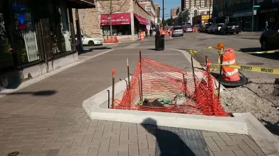
Planners are crafting the details of Chicago's first shared street, where pedestrians will rule.

"The Chicago Department of Transportation is currently hashing out an ordinance to regulate how motorists will behave on the Argyle 'shared street' [pdf], a pedestrian-priority zone slated for construction next year," reports John Greenfield and Steven Vance.
"The streetscape project — the first of its kind in Chicago — will create a plaza-like feel along Argyle from Broadway to Sheridan, by raising the street level and eliminating curbs. Slow motorized traffic and car parking will still be permitted on the street, but pedestrians will rule the space." 48th Ward Alderman Harry Osterman released final designs for the shared street concept in August.
The article provides more insight into the functional details of the shared street concept for Argyle Street, which caught the attention of the Chicago Tribune back in October of this year.
FULL STORY: City Writing New Rules of the Road to Allow Shared Space on Argyle Street

Chicago's Shared Street Off to a Bumpy Start
The shared street concept is being tested in Chicago, with goals of spurring economic development, allowing new and flexible use of public spaces, and increasing pedestrian safety.
Chicago's First Shared Street Planned for Uptown's Argyle Street
Following one failed attempt at a similar plan, a popular neighborhood for shopping will soon become a shared street project. The effort is part of a trend in Chicago looking for ways to transform streets into pedestrian friendly destinations.
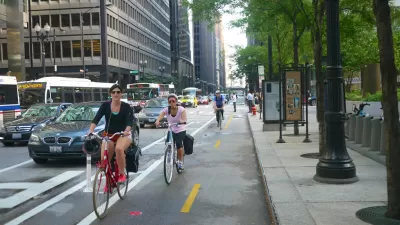
Bike Friendliness Ends at the City Border
A new report details the work Chicago's suburbs will have to do to live up to the bike-friendly example of its urban core.

Planetizen Federal Action Tracker
A weekly monitor of how Trump’s orders and actions are impacting planners and planning in America.

Congressman Proposes Bill to Rename DC Metro “Trump Train”
The Make Autorail Great Again Act would withhold federal funding to the system until the Washington Metropolitan Area Transit Authority (WMATA), rebrands as the Washington Metropolitan Authority for Greater Access (WMAGA).

DARTSpace Platform Streamlines Dallas TOD Application Process
The Dallas transit agency hopes a shorter permitting timeline will boost transit-oriented development around rail stations.

Renters Now Outnumber Homeowners in Over 200 US Suburbs
High housing costs in city centers and the new-found flexibility offered by remote work are pushing more renters to suburban areas.

The Tiny, Adorable $7,000 Car Turning Japan Onto EVs
The single seat Mibot charges from a regular plug as quickly as an iPad, and is about half the price of an average EV.

Supreme Court Ruling in Pipeline Case Guts Federal Environmental Law
The decision limits the scope of a federal law that mandates extensive environmental impact reviews of energy, infrastructure, and transportation projects.
Urban Design for Planners 1: Software Tools
This six-course series explores essential urban design concepts using open source software and equips planners with the tools they need to participate fully in the urban design process.
Planning for Universal Design
Learn the tools for implementing Universal Design in planning regulations.
Municipality of Princeton
Roanoke Valley-Alleghany Regional Commission
City of Mt Shasta
City of Camden Redevelopment Agency
City of Astoria
Transportation Research & Education Center (TREC) at Portland State University
US High Speed Rail Association
City of Camden Redevelopment Agency
Municipality of Princeton (NJ)