


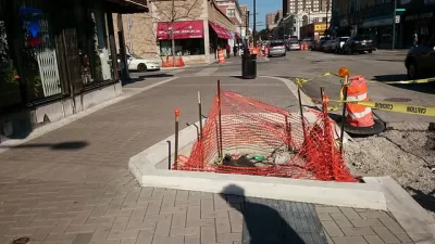
Following one failed attempt at a similar plan, a popular neighborhood for shopping will soon become a shared street project. The effort is part of a trend in Chicago looking for ways to transform streets into pedestrian friendly destinations.
Rachel Cromidas discusses Chicago's plans to transform some of its streets into pedestrian friendly environments by focusing on a proposal to create a shared street on Argyle Street in Uptown from Sheridan to Broadway. The plan would transform the street, according to Cromidas, "into a kind of public plaza, like those more common in Europe, where pedestrians, cyclists and motorists must co-exist in one broad lane elevated to the same height as the sidewalk."
"Construction on the street is set to begin this winter," reports Cromidas, with delivery targeted for summer of 2015. "The construction will involve raising the street level between Sheridan Road and Broadway to be flush with the sidewalk curb in hopes of helping drivers distinguish Argyle from a typical neighborhood street. The project will also bring the speed limit down to 15 miles per hour and eliminate up to 10 parking spots."
Cromidas compares the Argyle Street a similar proposal in Lincoln Park last fall, where DePaul University proposed converting a section of Kenmore Avenue between Belden and Fullerton avenues "into a landscaped walkway for students and other pedestrians." That plan ran into concerns over parking.
FULL STORY: Uptown's 'living street': Argyle to become more pedestrian friendly

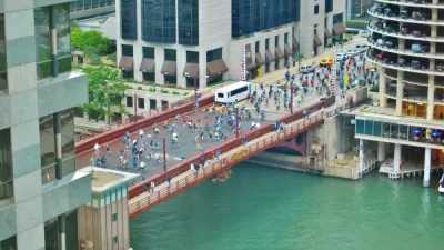
Chicago's Shared Street Off to a Bumpy Start
The shared street concept is being tested in Chicago, with goals of spurring economic development, allowing new and flexible use of public spaces, and increasing pedestrian safety.

Details on Chicago's First Shared Street
Planners are crafting the details of Chicago's first shared street, where pedestrians will rule.
Chicago Dismantles Leland 'Slow Street' Three Months Early
Citing neighborhood concerns, the city is ending the Slow Street program on Leland Street as more parks and beaches reopen, but advocates want to see more permanent traffic calming measures.

Planetizen Federal Action Tracker
A weekly monitor of how Trump’s orders and actions are impacting planners and planning in America.

Maui's Vacation Rental Debate Turns Ugly
Verbal attacks, misinformation campaigns and fistfights plague a high-stakes debate to convert thousands of vacation rentals into long-term housing.

Restaurant Patios Were a Pandemic Win — Why Were They so Hard to Keep?
Social distancing requirements and changes in travel patterns prompted cities to pilot new uses for street and sidewalk space. Then it got complicated.

In California Battle of Housing vs. Environment, Housing Just Won
A new state law significantly limits the power of CEQA, an environmental review law that served as a powerful tool for blocking new development.

Boulder Eliminates Parking Minimums Citywide
Officials estimate the cost of building a single underground parking space at up to $100,000.

Orange County, Florida Adopts Largest US “Sprawl Repair” Code
The ‘Orange Code’ seeks to rectify decades of sprawl-inducing, car-oriented development.
Urban Design for Planners 1: Software Tools
This six-course series explores essential urban design concepts using open source software and equips planners with the tools they need to participate fully in the urban design process.
Planning for Universal Design
Learn the tools for implementing Universal Design in planning regulations.
Heyer Gruel & Associates PA
JM Goldson LLC
Custer County Colorado
City of Camden Redevelopment Agency
City of Astoria
Transportation Research & Education Center (TREC) at Portland State University
Jefferson Parish Government
Camden Redevelopment Agency
City of Claremont