


A mapping project lead by Facebook's Connectivity Lab is gathering data from all over the atmosphere, and beyond, to make a comprehensive map of the world's buildings.
Tara Golsham shares news about a big data project underway at Facebook with tongue in cheek: "Facebook is making a map of every human-occupied building on Earth so that one day, people in the most remote areas of the world can also worry about what to do when their mom friends them on Facebook."
The mapping project is the work of Facebook's Connectivity Lab, "a group tasked with using drones, satellites, and lasers to improve internet access in developing countries," according to Golsham. For the mapping project, Connectivity Lab "has analyzed 21.6 million square kilometers' worth of satellite imagery — about 350 terabytes of data" to develop a much clearer picture of where buildings and structures are located in remote parts of world. That information is the first step in delivering Internet services to those remote areas.
The Connectivity Lab team has also created a post explaining the technical details of the mapping project.
FULL STORY: Why Facebook is making a map of every building in the world

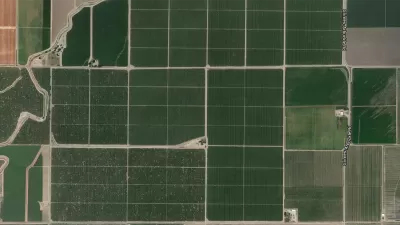
Facebook AI Maps Population Density
Facebook expects to release its worldwide maps of human density in the coming months—potential applications will likely be somewhere on the spectrum between humanitarian and commercial.

How the National Park Service Uses GIS
A new book demonstrates how the National Park Service uses GIS technology to meet its mission and showcases a selection of maps used for effectively managing national parks.
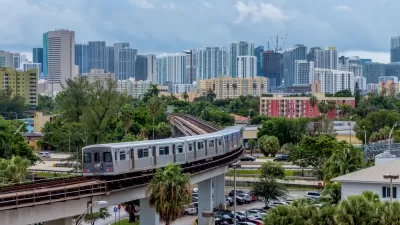
New Tool Puts Miami Development Opportunities on the Map
There's plenty of vacant or underutilized land to be found in Miami-Dade County, if you know where and how to look.

Planetizen Federal Action Tracker
A weekly monitor of how Trump’s orders and actions are impacting planners and planning in America.

Map: Where Senate Republicans Want to Sell Your Public Lands
For public land advocates, the Senate Republicans’ proposal to sell millions of acres of public land in the West is “the biggest fight of their careers.”

Restaurant Patios Were a Pandemic Win — Why Were They so Hard to Keep?
Social distancing requirements and changes in travel patterns prompted cities to pilot new uses for street and sidewalk space. Then it got complicated.

Platform Pilsner: Vancouver Transit Agency Releases... a Beer?
TransLink will receive a portion of every sale of the four-pack.

Toronto Weighs Cheaper Transit, Parking Hikes for Major Events
Special event rates would take effect during large festivals, sports games and concerts to ‘discourage driving, manage congestion and free up space for transit.”

Berlin to Consider Car-Free Zone Larger Than Manhattan
The area bound by the 22-mile Ringbahn would still allow 12 uses of a private automobile per year per person, and several other exemptions.
Urban Design for Planners 1: Software Tools
This six-course series explores essential urban design concepts using open source software and equips planners with the tools they need to participate fully in the urban design process.
Planning for Universal Design
Learn the tools for implementing Universal Design in planning regulations.
Heyer Gruel & Associates PA
JM Goldson LLC
Custer County Colorado
City of Camden Redevelopment Agency
City of Astoria
Transportation Research & Education Center (TREC) at Portland State University
Camden Redevelopment Agency
City of Claremont
Municipality of Princeton (NJ)