


Metro Transit officials announced the opening date for the A Line—the first of potentially many more rapid bus routes featuring platform level boarding and signal priority.
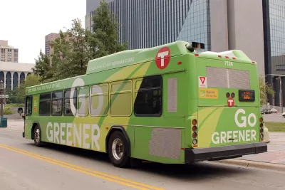
"The Twin Cities’ first arterial version of Bus Rapid Transit, or BRT, is set to begin passenger service on June 11," reports Peter Callaghan. Met Council Chair Adam Duininck announced the news earlier this week.
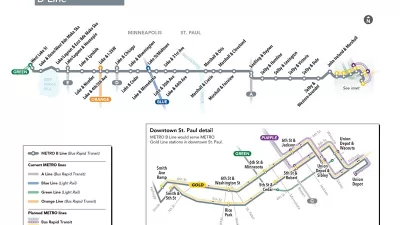
"The A Line route will begin at Rosedale, pass through St. Paul via Snelling Avenue and Ford Parkway and end in Minneapolis at the 46th Street light rail station," adds Callaghan.
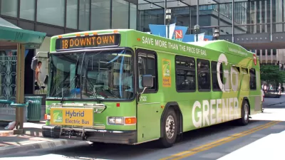
The article begins by pitching Bus Rapid Transit as an alternative to rail transit—both in cost and in the hearts of "transit snobs." The article eventually goes into detail about the features of this bus line, which will include some, but not all, of the perks of Bus Rapid Transit. All in all, the A Line is expected to complete its route 20 percent faster than existing buses. If riders take to the new A Line, "Metro Transit would like to build 11 BRT alignments on its most heavily traveled corridors by 2030," adds Callaghan.
FULL STORY: Seeking rail snobs: With BRT, Metro Transit aims to get more people onto buses

New Bus Rapid Transit Route Breaks Ground in the Twin Cities
The Twin Cities are on a mission to become the bus rapid transit capital of the United States. The latest improvement to advance that ambition broke ground earlier this week.
Gold Line Busway Planning Moves Forward in Suburban Minnesota
The cities of Oakdale and Lake Elmo made their opposition to a proposed busway connecting to St. Paul known by withdrawing their support for the project. Now Gold Line transit planners are refocusing their efforts on station location decisions.
Twin Cities Suburbs on an Anti-Bus Crusade
Residents of suburbs located east of St. Paul in Minnesota have coalesced to oppose the Gateway Corridor Gold Line project, which would connect 12 stops along a bus rapid transit line.

Planetizen Federal Action Tracker
A weekly monitor of how Trump’s orders and actions are impacting planners and planning in America.

Map: Where Senate Republicans Want to Sell Your Public Lands
For public land advocates, the Senate Republicans’ proposal to sell millions of acres of public land in the West is “the biggest fight of their careers.”

Restaurant Patios Were a Pandemic Win — Why Were They so Hard to Keep?
Social distancing requirements and changes in travel patterns prompted cities to pilot new uses for street and sidewalk space. Then it got complicated.

San Francisco Suspends Traffic Calming Amidst Record Deaths
Citing “a challenging fiscal landscape,” the city will cease the program on the heels of 42 traffic deaths, including 24 pedestrians.

California Homeless Arrests, Citations Spike After Ruling
An investigation reveals that anti-homeless actions increased up to 500% after Grants Pass v. Johnson — even in cities claiming no policy change.

Albuquerque Route 66 Motels Become Affordable Housing
A $4 million city fund is incentivizing developers to breathe new life into derelict midcentury motels.
Urban Design for Planners 1: Software Tools
This six-course series explores essential urban design concepts using open source software and equips planners with the tools they need to participate fully in the urban design process.
Planning for Universal Design
Learn the tools for implementing Universal Design in planning regulations.
Heyer Gruel & Associates PA
JM Goldson LLC
Custer County Colorado
City of Camden Redevelopment Agency
City of Astoria
Transportation Research & Education Center (TREC) at Portland State University
Camden Redevelopment Agency
City of Claremont
Municipality of Princeton (NJ)