


Not all transit maps are created equal. The new Portland TriMet map, for instance, does a much better job of illustrating the usefulness of its high-frequency network.
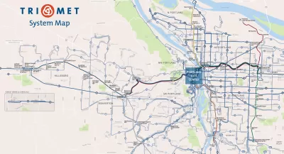
Evan Landman writes a post explain the importance of quality mapping to illustrate the frequent service routes in a bus system. To do so, Landman focuses on the city of Portland:
"Portland's agency TriMet has traditionally been a best practice example here, given their extensive Frequent Network branding down to the individual stop level, but curiously, their system map has not embraced this idea so wholeheartedly. Today, TriMet's new system map [pdf] changes that, introducing a cleaner, more readable map, which does a much better job of highlighting the agency's premier bus services."
The post goes on to describe how the design details have changed between the old map and the new. To summarize the key success of the new map: "This is a map that truly focuses on communicating the usefulness of the transit routes. The most important factor for usefulness is frequency, which is obscured when every line on the map is the same color, or a different color, or colored by a less important attribute, like which corner of the city it serves. "
FULL STORY: Portland: New Transit Map Underscores Frequent Network

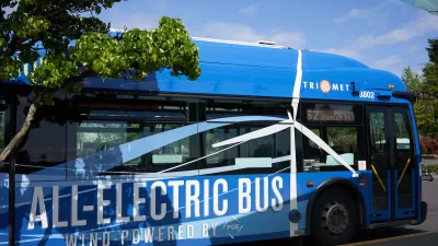
TriMet Ridership Grows Thanks to Realignment, Schedule Changes
The agency’s response to post-pandemic changes in travel behavior is paying off.
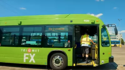
Portland ‘BRT Light’ Line Shows Promise
Despite not having fully dedicated bus lanes, Portland’s new ‘light’ bus rapid transit line is significantly reducing travel times.
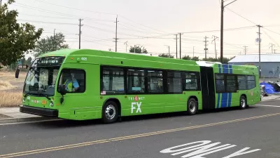
Portland ‘Frequent Express’ Bus Speeding Travel Times
TriMet’s newest line is improving service and reducing travel times for riders as ridership slowly recovers.

Planetizen Federal Action Tracker
A weekly monitor of how Trump’s orders and actions are impacting planners and planning in America.

Map: Where Senate Republicans Want to Sell Your Public Lands
For public land advocates, the Senate Republicans’ proposal to sell millions of acres of public land in the West is “the biggest fight of their careers.”

Restaurant Patios Were a Pandemic Win — Why Were They so Hard to Keep?
Social distancing requirements and changes in travel patterns prompted cities to pilot new uses for street and sidewalk space. Then it got complicated.

Platform Pilsner: Vancouver Transit Agency Releases... a Beer?
TransLink will receive a portion of every sale of the four-pack.

Toronto Weighs Cheaper Transit, Parking Hikes for Major Events
Special event rates would take effect during large festivals, sports games and concerts to ‘discourage driving, manage congestion and free up space for transit.”

Berlin to Consider Car-Free Zone Larger Than Manhattan
The area bound by the 22-mile Ringbahn would still allow 12 uses of a private automobile per year per person, and several other exemptions.
Urban Design for Planners 1: Software Tools
This six-course series explores essential urban design concepts using open source software and equips planners with the tools they need to participate fully in the urban design process.
Planning for Universal Design
Learn the tools for implementing Universal Design in planning regulations.
Heyer Gruel & Associates PA
JM Goldson LLC
Custer County Colorado
City of Camden Redevelopment Agency
City of Astoria
Transportation Research & Education Center (TREC) at Portland State University
Camden Redevelopment Agency
City of Claremont
Municipality of Princeton (NJ)