


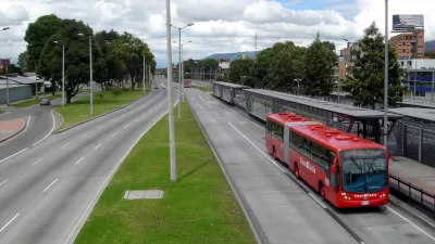
There are now 402 bus rapid transit (BRT) lines operating around the world, according to data from BRTData.org.
"Last week, bus rapid transit (BRT) reached a global milestone, as the number of mapped BRT corridors and systems in BRTData.org’s database broke 400," reports Ryan WInstead.
Adds Winstead: "BRTData’s most recent update shows that there are now 402 mapped BRT corridors and bus lanes, stretching over 5229 kilometers worldwide. The significance of this figure is twofold: first, it shows that many cities worldwide are becoming increasingly interested in sustainable modes of transport; secondly, the figure is a reflection of the vast amount of free and accessible data that exists online to support the case for BRT."
A few more factoids pulled from that data that Winstead mentions: nearly 33 million people use BRT in 195 cities every day, BRT lines quadrupled from 2004 to 2014, 48 cities are currently expanding BRT systems, and 141 cities are constructing or planning new BRT lines.
Winstead goes on to cite some of the data that describes the effects of BRT systems in cities around the world. In Istanbul, for instance, "the average passenger on Metrobüs saved 28 workdays per year in reduced travel times."
FULL STORY: BRT Hits 400 Corridors and Systems Worldwide

Setting a Higher Bar for Bus Rapid Transit
Changes to the BRTData.org criteria means fewer systems and corridors are considered to bus rapid transit.
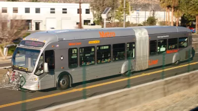
Los Angeles May Upgrade Orange Line BRT to Rail
The San Fernando Valley's Orange Line bus rapid transit enjoys solid ridership. For an area of the city especially under-served by trains, investing in light rail might be a viable option.
The Online Tool for Comparing Bus Rapid Transit Data
A tool from EMRARQ Brasil allows users to compile and compare data on the use and growth of bus rapid transit around the world, including in the United States, where 18 cities now use BRT or bus priority corridors.

Planetizen Federal Action Tracker
A weekly monitor of how Trump’s orders and actions are impacting planners and planning in America.

San Francisco's School District Spent $105M To Build Affordable Housing for Teachers — And That's Just the Beginning
SFUSD joins a growing list of school districts using their land holdings to address housing affordability challenges faced by their own employees.

The Tiny, Adorable $7,000 Car Turning Japan Onto EVs
The single seat Mibot charges from a regular plug as quickly as an iPad, and is about half the price of an average EV.

Seattle's Plan for Adopting Driverless Cars
Equity, safety, accessibility and affordability are front of mind as the city prepares for robotaxis and other autonomous vehicles.

As Trump Phases Out FEMA, Is It Time to Flee the Floodplains?
With less federal funding available for disaster relief efforts, the need to relocate at-risk communities is more urgent than ever.

With Protected Lanes, 460% More People Commute by Bike
For those needing more ammo, more data proving what we already knew is here.
Urban Design for Planners 1: Software Tools
This six-course series explores essential urban design concepts using open source software and equips planners with the tools they need to participate fully in the urban design process.
Planning for Universal Design
Learn the tools for implementing Universal Design in planning regulations.
Smith Gee Studio
City of Charlotte
City of Camden Redevelopment Agency
City of Astoria
Transportation Research & Education Center (TREC) at Portland State University
US High Speed Rail Association
City of Camden Redevelopment Agency
Municipality of Princeton (NJ)