A tool from EMRARQ Brasil allows users to compile and compare data on the use and growth of bus rapid transit around the world, including in the United States, where 18 cities now use BRT or bus priority corridors.


Priscilla Pacheco shares news of a redesigned platform to track the planning and construction of bus rapid transit around the world. Pacheco writes: "Does your city have BRT? Or, is your city planning a new system? You can find out that and much more on the redesigned BRTdata.org platform."
A rundown of the current state of BRT around the world: "With 19.3 million passengers per day, cities in Latin America account for 62% of all BRT or bus priority users. Brazil alone has more than 12 million daily passengers across 33 cities – with over three million in São Paulo and Rio de Janeiro each. Asia comes in second with 27% of global ridership, while the United States now has 18 cities with BRT or bus priority corridors."
Pacheco goes on to detail a key tool offered by BRTdata.org, the "BRT Panorama" tool, which "makes it possible for users to personalize their search, combining different indicators to generate comparative charts and visualize data."
Read the full story: 189 cities and counting: Track the growth of bus rapid transit on the redesigned BRTdata.org!

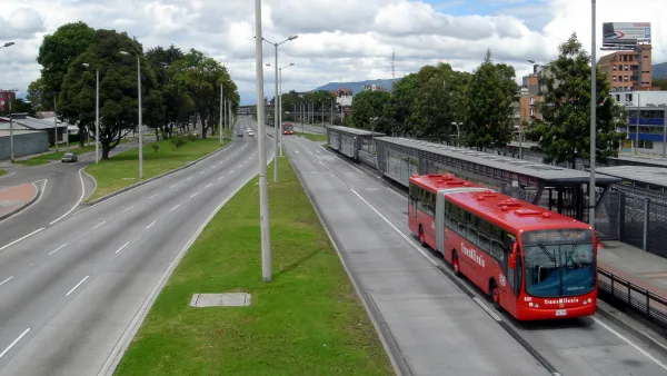
Setting a Higher Bar for Bus Rapid Transit
Changes to the BRTData.org criteria means fewer systems and corridors are considered to bus rapid transit.

Experts Reject Florida Study That Killed St. Pete Bus Lane as ‘Incomplete,’ ‘Unfair’
A transit activist has filed a suit against FDOT, which used a a one-page study to justify removing a dedicated bus lane.
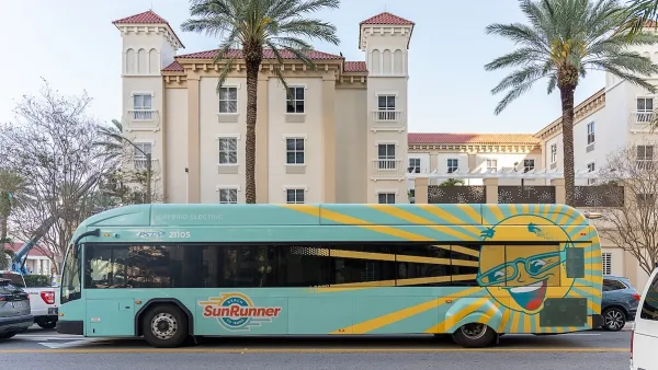
Florida DOT Orders Removal of St. Pete Bus Lane
The state says a popular BRT line has increased crashes and traffic on a state-owned portion of its corridor, prompting it to call for its reversal.

Planetizen Federal Action Tracker
A weekly monitor of how Trump’s orders and actions are impacting planners and planning in America.

The state-sanctioned urbicide of Austin
People don’t kill cities. Freeways do.

Colorado’s Largest Data Center Could Rise Next to Homes — Without a Public Hearing
The proposed campus would consume 11 times the power of Denver International Airport; as it has across the country, opposition mounts.

Nation's most wind-powered state turns to coal as data centers increase energy demand
For the first time in decades, Iowa has increased its generation of coal power.

NYC cools commuters with city's first rain garden above a bus stop
New York City officials say the plants in the rain garden can absorb 16 gallons of rainwater during heavy storms.

Brightline West’s future may rely on $6 billion federal loan
The company has until Nov. 2 to make a $400 million equity investment into its proposed high-speed rail line.

FREE Course: Walkable City 1: Why Walkability?
After describing his path towards focusing on walkability as the essence of good planning, Jeff Speck marches through his five principal reasons for making more walkable places.
Reinventing Malls: Planning Alchemy—Turning Gray Fields Into Gold
The course focuses on the opportunities and imperatives that shape reinvention of mall sites.

Greater Baltimore Committee
Eagle County Government
Harvard University Graduate School of Design
The Architects Foundation
University of Cincinnati Online
The Pocatello Development Authority
The Urban Renewal Agency of the City of Pocatello
Journal of the American Planning Association