


Researchers from the University of Texas identified the places in Dallas that suffer a lack of adequate transit service. Leading the list: Far North Dallas.
Brandon Formby provides in-depth coverage of the state of public transit in Far North Dallas, a part of the city recently named by University of Texas researchers as the worst transit desert in Dallas.
Five thousand residents live in Far North Dallas, located where the Dallas North Tollway and the Bush Turnpike intersect. Formby describes some of the conditions of the neighborhood:
"The area is mostly made up of apartment complexes clustered around just a handful of neighborhood streets. It’s miles from any light-rail stop. A north-south bus line that connects Addison to west Plano is the only fixed transit route that runs through the neighborhood. Buses come about every half-hour during weekday rush hours, but run only hourly the rest of those days and Saturdays. There is no Sunday service."
The article includes more insight into the research, which found additional transit deserts around the city. Dr. Junfeng Jiao, an assistant community and regional planning professor at the University of Texas School of Architecture, led the research.
Formby also quotes officials from DART in the story who express displeasure with the study's findings, specifically faulting the study's methods of measuring demand.
FULL STORY: Getting from place to place is frustrating for those in Far North Dallas 'transit desert'


Editorial: Expand Bus Service in Dallas
An Dallas Morning News editorial suggests DART spending should favor bus service over train service to make more efficient use of its funds.
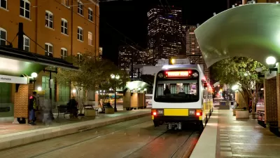
Dallas Streetcar Launches New Expansion
The expanded Dallas Streetcar began service the Bishop Arts District this week, an expansion of three-quarters-of-a-mile beyond the original route.
Dallas Puts New Downtown Light Rail Line on the Fast Track
The Dallas City Council has given preliminary approval to a proposed light rail line, currently called D2, which would add service capacity to the downtown core.

Planetizen Federal Action Tracker
A weekly monitor of how Trump’s orders and actions are impacting planners and planning in America.

Map: Where Senate Republicans Want to Sell Your Public Lands
For public land advocates, the Senate Republicans’ proposal to sell millions of acres of public land in the West is “the biggest fight of their careers.”

Restaurant Patios Were a Pandemic Win — Why Were They so Hard to Keep?
Social distancing requirements and changes in travel patterns prompted cities to pilot new uses for street and sidewalk space. Then it got complicated.

Platform Pilsner: Vancouver Transit Agency Releases... a Beer?
TransLink will receive a portion of every sale of the four-pack.

Toronto Weighs Cheaper Transit, Parking Hikes for Major Events
Special event rates would take effect during large festivals, sports games and concerts to ‘discourage driving, manage congestion and free up space for transit.”

Berlin to Consider Car-Free Zone Larger Than Manhattan
The area bound by the 22-mile Ringbahn would still allow 12 uses of a private automobile per year per person, and several other exemptions.
Urban Design for Planners 1: Software Tools
This six-course series explores essential urban design concepts using open source software and equips planners with the tools they need to participate fully in the urban design process.
Planning for Universal Design
Learn the tools for implementing Universal Design in planning regulations.
Heyer Gruel & Associates PA
JM Goldson LLC
Custer County Colorado
City of Camden Redevelopment Agency
City of Astoria
Transportation Research & Education Center (TREC) at Portland State University
Camden Redevelopment Agency
City of Claremont
Municipality of Princeton (NJ)