


A newly approved ordinance in San Francisco will allow new flexibility for the city parking regulations, relaxing parking restrictions in multiple situations that apply all over the city.
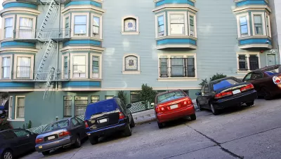
"The Board of Supervisors yesterday unanimously passed an ordinance removing some of SF’s 1950s-era parking mandates," reports Aaron Bialick.
"The 'Parking Flexibility Ordinance'…will make it easier for building owners and developers to avoid building car parking when it would impinge on the street environment for walking, bicycling, and transit. It would also count parking spaces against density limits, unless they’re built underground," adds Bialick.
Earlier coverage by Bialick provided more detail on the legislation, which, according to the article, "would waive parking mandates in certain situations, including when parking spaces require drivers to cross a curbside bike lane, transit-only lane, or a sidewalk that’s at least 25 feet wide. The additional flexibility will allow existing parking spots to be converted to other uses and let developers forego building new ones."
This isn't the first time San Francisco has managed to ease parking minimums. A 2011 ordinance eased restrictions in the South of Market (SoMa) neighborhood. Both the current ordinance and the 2011 ordinance were drafted with the help of the Livable City advocacy group. In a sign of how progressive San Francisco is sometime capable of being, the ordinance was "passed unanimously, without discussion, by both the full Board of Supervisors and the committee."
FULL STORY: Supervisors Pass Breed’s Bill to Loosen Some Parking Mandates

Washington State Legislature Passes Parking Reform Bill
A bill that would limit parking requirements for new developments is headed to the governor’s desk.
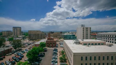
Denver Could Eliminate Parking Requirements
The city could remove parking mandates citywide to reduce the cost of housing construction and ease permitting for new projects.
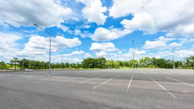
Parking Reform Yields New Housing
As more cities eliminate or reduce their minimum parking requirements, the impact on housing supply is coming into focus.

Planetizen Federal Action Tracker
A weekly monitor of how Trump’s orders and actions are impacting planners and planning in America.

Restaurant Patios Were a Pandemic Win — Why Were They so Hard to Keep?
Social distancing requirements and changes in travel patterns prompted cities to pilot new uses for street and sidewalk space. Then it got complicated.

Map: Where Senate Republicans Want to Sell Your Public Lands
For public land advocates, the Senate Republicans’ proposal to sell millions of acres of public land in the West is “the biggest fight of their careers.”

Maui's Vacation Rental Debate Turns Ugly
Verbal attacks, misinformation campaigns and fistfights plague a high-stakes debate to convert thousands of vacation rentals into long-term housing.

San Francisco Suspends Traffic Calming Amidst Record Deaths
Citing “a challenging fiscal landscape,” the city will cease the program on the heels of 42 traffic deaths, including 24 pedestrians.

California Homeless Arrests, Citations Spike After Ruling
An investigation reveals that anti-homeless actions increased up to 500% after Grants Pass v. Johnson — even in cities claiming no policy change.
Urban Design for Planners 1: Software Tools
This six-course series explores essential urban design concepts using open source software and equips planners with the tools they need to participate fully in the urban design process.
Planning for Universal Design
Learn the tools for implementing Universal Design in planning regulations.
Heyer Gruel & Associates PA
JM Goldson LLC
Custer County Colorado
City of Camden Redevelopment Agency
City of Astoria
Transportation Research & Education Center (TREC) at Portland State University
Camden Redevelopment Agency
City of Claremont
Municipality of Princeton (NJ)