


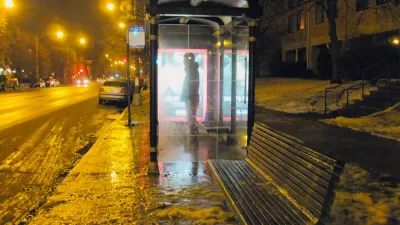
Research from Brookings puts Cleveland in last place for improving access to jobs from 2000 through 2012. And jobs sprawl is up throughout the rest of the country as well.

Despite all we hear about a return to density, research from Brookings shows rising distances between people and their jobs. And Cleveland, Ohio seems to be having the most difficulty containing 'jobs sprawl,' the suburbanization of employment. From 2000 to 2012, Northeast Ohio suffered an average of -26.5% job access, defined as percentage of jobs that can be reached in a typical commute.
From the article: "The worst was felt by the city of Cleveland (-26%), but the wave has hit the suburbs in Cuyahoga County and the western half of Lorain County as well (-22.9%). Job sprawl was particularly bad for areas below poverty level (-35%) and in 'majority-minority' areas of the region (-28%). Jobs leaving the metro region totaled 18% in that period."
So far, attempts to ameliorate this problem have been abstract, as in regional plans. Marc Lefkowitz writes, "Ideally, as Ohio promises to better align its transportation funding with performance metrics, it will look at jobs/transit access as one of the areas of improvement."
FULL STORY: Cleveland: Dead last in controlling jobs sprawl

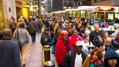
Poor Suburbs Struggle with Job Sprawl
Although unemployment has declined, according to this report commutes are getting longer. "Job sprawl" often plagues minority and poor areas where housing is more affordable.
Report: Congestion Pricing Could Speed Bus Trips
Advocates say New York's plan traffic management plan could raise $1.5 billion while saving express bus commuters hours per week.
As the State Abandons Public Transit, Is a Regional Solution Possible for Northeast Ohio?
Many states cover around 20 percent of the costs of public transit. In Ohio, that figure has dropped to 1 percent.

Planetizen Federal Action Tracker
A weekly monitor of how Trump’s orders and actions are impacting planners and planning in America.

Map: Where Senate Republicans Want to Sell Your Public Lands
For public land advocates, the Senate Republicans’ proposal to sell millions of acres of public land in the West is “the biggest fight of their careers.”

Restaurant Patios Were a Pandemic Win — Why Were They so Hard to Keep?
Social distancing requirements and changes in travel patterns prompted cities to pilot new uses for street and sidewalk space. Then it got complicated.

Platform Pilsner: Vancouver Transit Agency Releases... a Beer?
TransLink will receive a portion of every sale of the four-pack.

Toronto Weighs Cheaper Transit, Parking Hikes for Major Events
Special event rates would take effect during large festivals, sports games and concerts to ‘discourage driving, manage congestion and free up space for transit.”

Berlin to Consider Car-Free Zone Larger Than Manhattan
The area bound by the 22-mile Ringbahn would still allow 12 uses of a private automobile per year per person, and several other exemptions.
Urban Design for Planners 1: Software Tools
This six-course series explores essential urban design concepts using open source software and equips planners with the tools they need to participate fully in the urban design process.
Planning for Universal Design
Learn the tools for implementing Universal Design in planning regulations.
Heyer Gruel & Associates PA
JM Goldson LLC
Custer County Colorado
City of Camden Redevelopment Agency
City of Astoria
Transportation Research & Education Center (TREC) at Portland State University
Camden Redevelopment Agency
City of Claremont
Municipality of Princeton (NJ)