


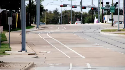
The St. Paul City Council approved a bike plan on March 18, 2014 that will more than double the amount of bike pathways and connections in the city. The plan will advance the goals established by the city's 2008 Comprehensive Plan.
The St. Paul City Council approved its long-awaited bike plan [pdf] this week, reports Peter Callaghan. "Approved on a 6-0 vote, the plan identifies routes that would see the current network of 153 miles of paths and shared bike lanes grow to 346 miles. While the plan includes some shared lanes, it emphasizes off-street paths and separated lanes," writes Callaghan.
"St. Paul city planner Reuben Collins said the goal of the bike plan is to have every resident of the city within a quarter mile of a formal trail. But it also addresses issues such as bike storage, signalization, zoning changes and wayfinding. And it calls for the completion of the century-old vision of the Grand Round — a 27-mile scenic parkway for cars and bikes that would connect the Mississippi River, Como Lake and Lake Phalen."
Callaghan also notes that the bike plan includes one big ticket item that could make bike aficionados in other cities envious: an oval bike loop around downtown. That component of the plan has provoked resistance from downtown business interests concerned about losing parking spaces—150 parking spaces according to the plan's estimates. Those concerns led the council to "[put] off decisions on the details of the loop until a consultant could be hired and a resident task-force could meet," according to Callaghan.
FULL STORY: St. Paul approves bike plan, punts on parking decision

Bicycle Plan Leads to Parking Policy Questions in St. Paul
St. Paul is in the community engagement stage of a bike planning process expected to culminate early next year. Among the bike plan's proposals, none have sparked as much controversy as a downtown loop that would remove street parking.
Dallas Makes First-Ever Annual Commitment to its Bike Lane Program
Dallas is making new commitments to alternative transportation options—the latest example is found in a budget expenditure for several bike lane projects.
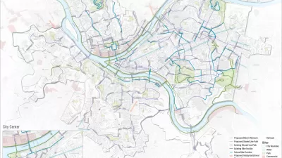
Hundreds of Miles of New Bike Lanes Coming to Pittsburgh
Checking in with the Bike(+) Plan in Pittsburgh.

Planetizen Federal Action Tracker
A weekly monitor of how Trump’s orders and actions are impacting planners and planning in America.

Map: Where Senate Republicans Want to Sell Your Public Lands
For public land advocates, the Senate Republicans’ proposal to sell millions of acres of public land in the West is “the biggest fight of their careers.”

Restaurant Patios Were a Pandemic Win — Why Were They so Hard to Keep?
Social distancing requirements and changes in travel patterns prompted cities to pilot new uses for street and sidewalk space. Then it got complicated.

Platform Pilsner: Vancouver Transit Agency Releases... a Beer?
TransLink will receive a portion of every sale of the four-pack.

Toronto Weighs Cheaper Transit, Parking Hikes for Major Events
Special event rates would take effect during large festivals, sports games and concerts to ‘discourage driving, manage congestion and free up space for transit.”

Berlin to Consider Car-Free Zone Larger Than Manhattan
The area bound by the 22-mile Ringbahn would still allow 12 uses of a private automobile per year per person, and several other exemptions.
Urban Design for Planners 1: Software Tools
This six-course series explores essential urban design concepts using open source software and equips planners with the tools they need to participate fully in the urban design process.
Planning for Universal Design
Learn the tools for implementing Universal Design in planning regulations.
Heyer Gruel & Associates PA
JM Goldson LLC
Custer County Colorado
City of Camden Redevelopment Agency
City of Astoria
Transportation Research & Education Center (TREC) at Portland State University
Camden Redevelopment Agency
City of Claremont
Municipality of Princeton (NJ)