


Successful driverless cars might lead to "mini mass transit," a distinct mode from public transit and the private automobile. The consequences for land use could reshape suburbia.
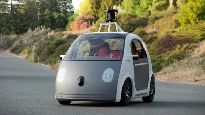
David Edmondson speculates on the effects of widespread driverless cars. He envisions a system of personal rapid transit by way of app-driven car sharing. "Open up an app on a phone, order a car, and a vehicle (possibly with others in it going to roughly where you're going) will drive by, pick you up, and drop you off near your destination. Along the way it'll pick up other people going in roughly the same direction as you, bolstering capacity of the personal car to a grand total of five. Five trips, one car. As one Twitter follower called it, it becomes mini-mass transit, but at the beck and call of an app and as flexible as it needs to be."
Significant changes to suburban transportation planning would follow. "Unlike streetcars, the whole street is a possible stop. Rather than a series of one-dimensional stops surrounded by a station area, there is a two-dimensional transportation corridor surrounded by a transportation area."
The article considers potential effects on land use, road design, and suburban density. In time, driverless car transit might shift the definition of "suburban." Edmondson writes, "With no parking lots, no wide roads, a street grid, and shops and homes clustered up against the sidewalk, [suburbia] sounds more like a town center. That's because this transportation cloud functions much more like the streetcars of the old days than personal cars of today."
FULL STORY: What do driverless cars mean for suburban planning?

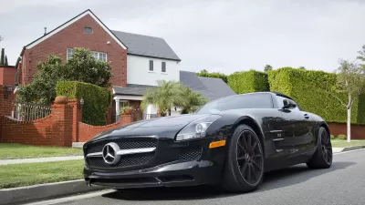
Mercedes-Benz Bets on a Suburban Future
From a new Silicon Valley facility, Mercedes' R&D department is developing car-share services based on a vision of 21st-century suburbs. The company is also testing self-driving prototypes and electric models.
How Parking Apps Could Shift the Parking Landscape
New apps have the potential to influence a fundamental shift in the political and physical realities of parking according to a recent Next City article.
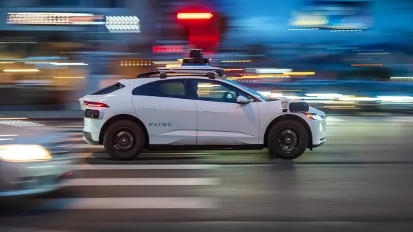
Seattle's Plan for Adopting Driverless Cars
Equity, safety, accessibility and affordability are front of mind as the city prepares for robotaxis and other autonomous vehicles.

Planetizen Federal Action Tracker
A weekly monitor of how Trump’s orders and actions are impacting planners and planning in America.

Restaurant Patios Were a Pandemic Win — Why Were They so Hard to Keep?
Social distancing requirements and changes in travel patterns prompted cities to pilot new uses for street and sidewalk space. Then it got complicated.

Map: Where Senate Republicans Want to Sell Your Public Lands
For public land advocates, the Senate Republicans’ proposal to sell millions of acres of public land in the West is “the biggest fight of their careers.”

Maui's Vacation Rental Debate Turns Ugly
Verbal attacks, misinformation campaigns and fistfights plague a high-stakes debate to convert thousands of vacation rentals into long-term housing.

San Francisco Suspends Traffic Calming Amidst Record Deaths
Citing “a challenging fiscal landscape,” the city will cease the program on the heels of 42 traffic deaths, including 24 pedestrians.

California Homeless Arrests, Citations Spike After Ruling
An investigation reveals that anti-homeless actions increased up to 500% after Grants Pass v. Johnson — even in cities claiming no policy change.
Urban Design for Planners 1: Software Tools
This six-course series explores essential urban design concepts using open source software and equips planners with the tools they need to participate fully in the urban design process.
Planning for Universal Design
Learn the tools for implementing Universal Design in planning regulations.
Heyer Gruel & Associates PA
JM Goldson LLC
Custer County Colorado
City of Camden Redevelopment Agency
City of Astoria
Transportation Research & Education Center (TREC) at Portland State University
Camden Redevelopment Agency
City of Claremont
Municipality of Princeton (NJ)