


Wisconsin state transportation officials have settled on a plan to expand the I-94 freeway in Milwaukee—instead of building a double deck freeway through a cemetery the plan is too widen the freeway without disturbing an human remains.
"The proposed expansion of the I-94 east-west freeway between 16th and 70th streets in Milwaukee will be accomplished in the traditional way by adding a lane of traffic in each direction," reports Don Behm. The "traditional way" is opposed to an alternative proposal that would have build a second level for a 2,000-foot corridor through the Spring Hill Cemetery.
"The revised cost of the eight-lane expansion is estimated at $850 million — less than the $1.5 billion estimate for the most expensive option," adds Behm.
In a separate, earlier article covering the expansion plans, Behm noted differences of opinions about how much traffic the freeway should expect in the future.
According to a study by the state Department of Transportation the section of freeway under consideration "carries between 143,000 to 160,500 vehicles on an average weekday. By 2040, traffic volumes are expected to rise to around 160,000 to 186,000 vehicles per weekday."
However, "opponents of expansion claim vehicle numbers are dropping. A 2014 report by 1000 Friends of Wisconsin found that traffic counts on this stretch of highway decreased 8% from 2000 to 2012."
FULL STORY: State rejects double-deck lanes for I-94 east-west freeway

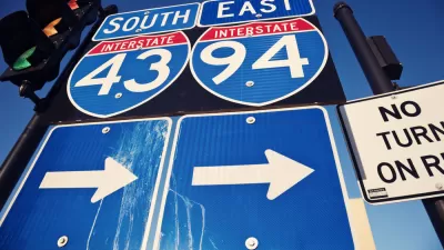
Wisconsin To Expand Interstate 94 in Milwaukee
The state’s department of transportation is moving forward with a proposal that will expand the freeway to eight lanes, rejecting a ‘Fix at Six’ plan that would have kept the existing six lanes.

Opinion: Proposed I-94 Expansion a 'Fiasco' for Milwaukee
An opinion piece published by Urban Milwaukee argues against a proposed expansion of three miles of Interstate 94 in Milwaukee.
New Governor, Same Billion Dollar Freeway Expansion Plan
Wisconsin Gov. Tony Evers is picking up a plan previously championed and abandoned by former Gov. Scott Walker: The North-South expansion of I-94 west of Milwaukee.

Planetizen Federal Action Tracker
A weekly monitor of how Trump’s orders and actions are impacting planners and planning in America.

Restaurant Patios Were a Pandemic Win — Why Were They so Hard to Keep?
Social distancing requirements and changes in travel patterns prompted cities to pilot new uses for street and sidewalk space. Then it got complicated.

Map: Where Senate Republicans Want to Sell Your Public Lands
For public land advocates, the Senate Republicans’ proposal to sell millions of acres of public land in the West is “the biggest fight of their careers.”

Maui's Vacation Rental Debate Turns Ugly
Verbal attacks, misinformation campaigns and fistfights plague a high-stakes debate to convert thousands of vacation rentals into long-term housing.

San Francisco Suspends Traffic Calming Amidst Record Deaths
Citing “a challenging fiscal landscape,” the city will cease the program on the heels of 42 traffic deaths, including 24 pedestrians.

California Homeless Arrests, Citations Spike After Ruling
An investigation reveals that anti-homeless actions increased up to 500% after Grants Pass v. Johnson — even in cities claiming no policy change.
Urban Design for Planners 1: Software Tools
This six-course series explores essential urban design concepts using open source software and equips planners with the tools they need to participate fully in the urban design process.
Planning for Universal Design
Learn the tools for implementing Universal Design in planning regulations.
Heyer Gruel & Associates PA
JM Goldson LLC
Custer County Colorado
City of Camden Redevelopment Agency
City of Astoria
Transportation Research & Education Center (TREC) at Portland State University
Camden Redevelopment Agency
City of Claremont
Municipality of Princeton (NJ)