


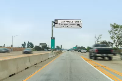
Only nine regions experienced reduced traffic congestion between 1991 and 2011. What do they have in common?

Recently, I read an email newsletter arguing that cities really can build their way out of congestion, because the regions that have actually reduced congestion have built so many roads that the increased road mileage actually exceeded the increase in vehicle miles traveled.
I have no doubt that this proposition is true for the past few years, but only because over the past decade or so, congestion decreased in most cities, regardless of their policies. According to the Texas Transportation Institute (TTI), the number of hours per driver lost per congestion in the 101 largest urbanized areas decreased from 52 in 2005 (its all-time high) to 43 in 2011—the same level as in 1996. (All TTI data discussed here are available at an Excel spreadsheet available at this link.)
But to me, the more interesting question is the long-term trend, starting from 1982 (the first year of TTI’s statistical database). Because congestion increased almost everywhere during the 1980s and 1990s, only three regions are less congested (as measured by hours lost per driver) than 30 years ago: Anchorage, Alaska, Indio-Palm Springs, California, and Lancaster, California.
In Anchorage, the number of freeway lane miles did not keep up with vehicle miles traveled (VMT): VMT increased by just over 70 percent (from 800,000 to 1.38 million) and lane-miles increased by just over 50 percent (from 125 to 190). However, arterial lane-miles did grow more rapidly, increasing by 28 percent (from 300 to 386) while arterial VMT increased by less than 20 percent.
In Indio, freeway miles increased by 144 percent (from 45 miles to 110) while VMT again increased somewhat more rapidly, by 171 percent (from 390,000 to 1.058 million). Arterial streets increased by 136 percent (from 345 miles to 817), while arterial street VMT increased by 179 percent (from 1.6 million to 4.473 million). So even for arterial streets, VMT actually increased more rapidly than road mileage.
In Lancaster, freeway miles barely budged (from 70 to 80) while freeway VMT more than tripled. On the other hand, arterial lane-mileage did grow quite rapidly, from 270 to 806, while arterial VMT did not even double.
In other words, in all three metro areas the number of freeway lane miles increased more slowly than freeway VMT. However, in two of the three regions arterial lane-miles grew more rapidly than VMT. So to the extent that road-building correlates with reduced congestion, that correlation is much stronger for arterials than for freeways.
To get a broader sample size (and a sample that includes big cities), I looked at a larger group of urbanized areas: those with less congestion in 2011 than twenty years earlier (but still more than in 1982). This group includes Boulder, Los Angeles, Pittsburgh, Sacramento, San Francisco, and San Jose.
In every single one of these places, freeway miles grew more slowly than freeway VMT. So it is not (over this long period) right to say that any region reduced congestion by adding freeway miles at a rate that exceeded VMT growth. On the other hand, arterial lane-miles grew more rapidly than arterial VMT for all of the regions but San Jose. Thus, nonfreeway street growth may correlate with reduced congestion. In other words, no region built their way out of congestion with freeways, but a stronger case may exist for creating more arterial streets.
Both smart growth supporters and road lobby supporters might have reason to feel validated by this result: both groups tend to favor grid systems with lots of commercial streets, as opposed to street systems that concentrate almost all traffic on a few interstate highways and huge arterials.
On the other hand, these cities did not add huge amounts of lane-mileage. Between 1991 and 2011, the average arterial lane-mileage in the 101 largest urbanized areas increased by 35 percent (from 2127 to 2876). In all but two of the nine regions discussed above (Indio and Lancaster) arterial lane-mileage grew more slowly than the national average (and in a third, Sacramento, it grew at almost as fast a pace).
In other words, most of our congestion-busting regions did not succeed by building lots of streets; instead, they built streets more slowly than most other regions, but VMT increased even more slowly. This suggests that in the long run, the most effective way to reduce congestion is to drive less.


Judge Extends NYC Congestion Pricing Through at Least June 9
A federal judge halted the Trump administration’s effort to kill the program, which remains in limbo as a lawsuit filed by the MTA moves forward.

NYC Congestion Pricing Continues to Show Positive Results
While the Trump administration attempts to revoke the program’s federal approval, congestion pricing continues to reduce traffic, speed up bus travel times, and improve air quality in Manhattan.

Philadelphia Is Expanding its Network of Roundabouts
Roundabouts are widely shown to decrease traffic speed, reduce congestion, and improve efficiency.

Planetizen Federal Action Tracker
A weekly monitor of how Trump’s orders and actions are impacting planners and planning in America.

Map: Where Senate Republicans Want to Sell Your Public Lands
For public land advocates, the Senate Republicans’ proposal to sell millions of acres of public land in the West is “the biggest fight of their careers.”

Restaurant Patios Were a Pandemic Win — Why Were They so Hard to Keep?
Social distancing requirements and changes in travel patterns prompted cities to pilot new uses for street and sidewalk space. Then it got complicated.

Platform Pilsner: Vancouver Transit Agency Releases... a Beer?
TransLink will receive a portion of every sale of the four-pack.

Toronto Weighs Cheaper Transit, Parking Hikes for Major Events
Special event rates would take effect during large festivals, sports games and concerts to ‘discourage driving, manage congestion and free up space for transit.”

Berlin to Consider Car-Free Zone Larger Than Manhattan
The area bound by the 22-mile Ringbahn would still allow 12 uses of a private automobile per year per person, and several other exemptions.
Urban Design for Planners 1: Software Tools
This six-course series explores essential urban design concepts using open source software and equips planners with the tools they need to participate fully in the urban design process.
Planning for Universal Design
Learn the tools for implementing Universal Design in planning regulations.
Heyer Gruel & Associates PA
JM Goldson LLC
Custer County Colorado
City of Camden Redevelopment Agency
City of Astoria
Transportation Research & Education Center (TREC) at Portland State University
Camden Redevelopment Agency
City of Claremont
Municipality of Princeton (NJ)