


A "wonderfully simplified" map of San Francisco's best bicycle routes modeled on Harry Beck's revolutionary map for the London Underground aims to encourage people to saddle up through clean graphic design.
Over the weekend, we looked at the importance of comparing time and cost savings for encouraging bike use over other transportation modes. Another way to get potential riders to grab two wheels is to make clear the best ways to navigate a city's existing bicycle infrastructure. That's the idea, at least, behind Mat Kladney's "San Francisco Bicycle System" [PDF], a "wonderfully simplified version of San Francisco's bicycle infrastructure, with routes between popular destinations given as colorized tubes not unlike the city's metro map," writes Eric Jaffe.
"Kladney purposefully made design references to urban subway maps because he believes people are more apt to bike if they think it'll be as easy as riding the train. 'Need to get from Downtown to the Bernal Heights? Just follow the Blue Line,' he says. 'This simplicity will re-frame the existing San Francisco bicycle lanes as the San Francisco Bicycle System and will help convince more people to saddle up and take to the streets.'"
FULL STORY: A Wonderfully Simplified Map of San Francisco's Bicycle Infrastructure

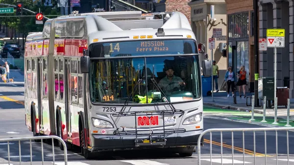
How to Fund SF’s Muni Without Cutting Service
Three solutions for bridging the San Francisco transit agency’s budget gap without reducing service for transit-dependent riders.

San Francisco's School District Spent $105M To Build Affordable Housing for Teachers — And That's Just the Beginning
SFUSD joins a growing list of school districts using their land holdings to address housing affordability challenges faced by their own employees.

The Simple Legislative Tool Transforming Vacant Downtowns
In California, Michigan and Georgia, an easy win is bringing dollars — and delight — back to city centers.

Planetizen Federal Action Tracker
A weekly monitor of how Trump’s orders and actions are impacting planners and planning in America.

Map: Where Senate Republicans Want to Sell Your Public Lands
For public land advocates, the Senate Republicans’ proposal to sell millions of acres of public land in the West is “the biggest fight of their careers.”

Restaurant Patios Were a Pandemic Win — Why Were They so Hard to Keep?
Social distancing requirements and changes in travel patterns prompted cities to pilot new uses for street and sidewalk space. Then it got complicated.

Platform Pilsner: Vancouver Transit Agency Releases... a Beer?
TransLink will receive a portion of every sale of the four-pack.

Toronto Weighs Cheaper Transit, Parking Hikes for Major Events
Special event rates would take effect during large festivals, sports games and concerts to ‘discourage driving, manage congestion and free up space for transit.”

Berlin to Consider Car-Free Zone Larger Than Manhattan
The area bound by the 22-mile Ringbahn would still allow 12 uses of a private automobile per year per person, and several other exemptions.
Urban Design for Planners 1: Software Tools
This six-course series explores essential urban design concepts using open source software and equips planners with the tools they need to participate fully in the urban design process.
Planning for Universal Design
Learn the tools for implementing Universal Design in planning regulations.
Heyer Gruel & Associates PA
JM Goldson LLC
Custer County Colorado
City of Camden Redevelopment Agency
City of Astoria
Transportation Research & Education Center (TREC) at Portland State University
Camden Redevelopment Agency
City of Claremont
Municipality of Princeton (NJ)