


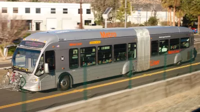
For anyone who's tried to commute between the San Fernando Valley and L.A.'s Westside during rush hour, it's clear the existing options just don't work. LA County is now considering six options - from BRT to rail tunnels - to help ease congestion.
Although Los Angeles is currently spending more than $1 billion to widen the 405 Freeway by one carpool lane northbound through the Sepulveda Pass, it's clear that more creative solutions will be required to dramatically improve the commute between the Westside and the Valley. Eric Jaffe looks at six options [PDF] that the Los Angeles County Metropolitan Transportation Authority (Metro) presented Valley residents with last week.
The most modest option would stripe 8.5 miles of the 405 for rapid bus use during peak hours at a cost of $162 million. According to Jaffe, "[t]he project is very cost-efficient and creates a minimal environmental impact, but Metro officials worry it doesn't provide the reliable, long-term transit option the corridor needs."
The most outlandish option would be build 21-mile-long highway and transit tunnels from the Valley to Los Angeles International Airport at an estimated cost of $30-38 billion. "This 'ultimate build-out'," says Jaffe, "would certainly require a private partnership, but suitors are out there; at least six companies have already reached out to Metro with an interest in building a tunnel for the corridor."
"For now," writes "Metro has $1 billion allotted for the Sepulveda Pass Corridor project, thanks to a half-percent sales tax that voters approved in 2008. That money, however, would not be available until 2039."
FULL STORY: 6 Ideas for L.A.'s Next Great Transit Project


L.A. Metro Report Examines How Women Travel
Findings from a new study about the mobility needs and concerns of women in Los Angeles will inform future initiatives and planning.
Thinking Outside of the Transit Box in L.A.
Metro is analyzing new geolocational data to look beyond conventional understandings of travel behavior.
Why Replace Successful BRT With Rail?
The Orange Line, a bus rapid transit line running through Los Angeles' San Fernando Valley, has been a success. To those calling for an expensive conversion to rail, several experts say, why bother?

Planetizen Federal Action Tracker
A weekly monitor of how Trump’s orders and actions are impacting planners and planning in America.

Restaurant Patios Were a Pandemic Win — Why Were They so Hard to Keep?
Social distancing requirements and changes in travel patterns prompted cities to pilot new uses for street and sidewalk space. Then it got complicated.

Map: Where Senate Republicans Want to Sell Your Public Lands
For public land advocates, the Senate Republicans’ proposal to sell millions of acres of public land in the West is “the biggest fight of their careers.”

Orange County, Florida Adopts Largest US “Sprawl Repair” Code
The ‘Orange Code’ seeks to rectify decades of sprawl-inducing, car-oriented development.

Maui's Vacation Rental Debate Turns Ugly
Verbal attacks, misinformation campaigns and fistfights plague a high-stakes debate to convert thousands of vacation rentals into long-term housing.

San Francisco Suspends Traffic Calming Amidst Record Deaths
Citing “a challenging fiscal landscape,” the city will cease the program on the heels of 42 traffic deaths, including 24 pedestrians.
Urban Design for Planners 1: Software Tools
This six-course series explores essential urban design concepts using open source software and equips planners with the tools they need to participate fully in the urban design process.
Planning for Universal Design
Learn the tools for implementing Universal Design in planning regulations.
Heyer Gruel & Associates PA
JM Goldson LLC
Custer County Colorado
City of Camden Redevelopment Agency
City of Astoria
Transportation Research & Education Center (TREC) at Portland State University
Camden Redevelopment Agency
City of Claremont
Municipality of Princeton (NJ)