


Raleigh, North Carolina didn't take getting placed sixth most dangerous metro area in the country lightly back in 2009, and recently drafted a Comprehensive Pedestrian Plan in response.
“In 2009, the think tank Transportation for America released a report called "Dangerous by Design" [PDF], ranking the least pedestrian-friendly metro areas in the country” reports Eric Jaffe, adding, “Raleigh, North Carolina, placed sixth—as in sixth most dangerous.” According to Fleming El-Amin, one of the city's transportation planners, “That was a bit of an eye opener." Following a lengthy public commentary period, Raleigh is now set to release its response to their public pedestrian shaming - a final version of the draft Comprehensive Pedestrian Plan released last October.
The plan includes physical and psychological elements for making the city more walkable. They physical component includes the creation of up to 212 miles of new sidewalks, which utilizes "a new GIS-based prioritization system that ranks sidewalk projects on both 'need' and 'demand.'" The psychological approach is focused on getting drivers to change their behavior and “to be more observant, and tolerant, of pedestrians.” It also includes the possibility of expanding the city's popular guerrilla wayfinding effort, Walk Raleigh, which helps pedestrians better calculate walking times through signage.
Though the city does not have specific success targets yet, it has already improved to 13th worst pedestrian city in a more recent 2011 report [PDF]. And, El-Amin asserts that this is not just a local issue, but a much larger one for the country, “I think when we really make a shift, either statewide or nationally, to think about every street as a complete street, it'll be more at the forefront to look at pedestrian mobility and connectivity more holistically and comprehensively."
FULL STORY: Raleigh's Pedestrian Rebound

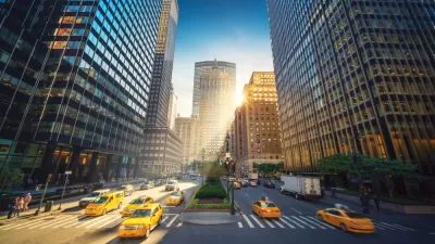
The Once and Future Park Avenue Promenade
The debate about whether the pedestrian-oriented changes made to the New York City streetscape during the pandemic should be permanent has a high-profile battleground on Park Avenue.

Surgeon General Warning to Local Governments: Stop Being So Auto-Centric!
No, those will not be the precise words of the forthcoming "Call to Action" by Surgeon General Vice Admiral Vivek H. Murthy, but he will call on cities to "design and build roads and public places to make walking easier, safer, and more pleasant."
Planning to Walk
In the final installment of his series on "Walking in America" on Slate, Tom Vanderbilt looks at why so much of the built environment is hostile to pedestrians, and how planning can change that.

Planetizen Federal Action Tracker
A weekly monitor of how Trump’s orders and actions are impacting planners and planning in America.

Map: Where Senate Republicans Want to Sell Your Public Lands
For public land advocates, the Senate Republicans’ proposal to sell millions of acres of public land in the West is “the biggest fight of their careers.”

Restaurant Patios Were a Pandemic Win — Why Were They so Hard to Keep?
Social distancing requirements and changes in travel patterns prompted cities to pilot new uses for street and sidewalk space. Then it got complicated.

Albuquerque Route 66 Motels Become Affordable Housing
A $4 million city fund is incentivizing developers to breathe new life into derelict midcentury motels.

DC Area County Eliminates Bus Fares
Montgomery County joins a growing trend of making transit free.

Platform Pilsner: Vancouver Transit Agency Releases... a Beer?
TransLink will receive a portion of every sale of the four-pack.
Urban Design for Planners 1: Software Tools
This six-course series explores essential urban design concepts using open source software and equips planners with the tools they need to participate fully in the urban design process.
Planning for Universal Design
Learn the tools for implementing Universal Design in planning regulations.
Heyer Gruel & Associates PA
JM Goldson LLC
Custer County Colorado
City of Camden Redevelopment Agency
City of Astoria
Transportation Research & Education Center (TREC) at Portland State University
Camden Redevelopment Agency
City of Claremont
Municipality of Princeton (NJ)