


In many parts of the city located on higher ground than Lower Manhattan, the lights are on and the flood waters have receded. But New York's transportation network is struggling to reconnect the city's business centers with commuters.
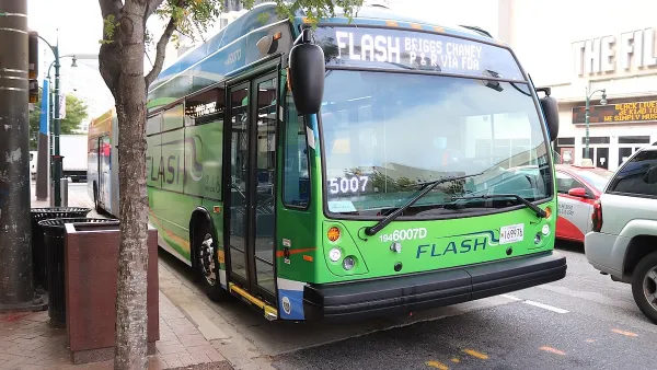
Three days after superstorm Sandy struck New York, the city's public transit system, which 31.1% of commuters in the greater metro area utilize daily, is crawling back to life. Matt Flegenheimer and John Leland provide an update on the recovery of the regional transportation system, as New Yorkers seek a return to some modicum of normalcy.
"[W]ith the return of some services on Thursday," write Flegenheimer and Leland, "commuters were hopeful
they would experience less of what they encountered on Wednesday, when
bus rides were free but still unappealing as they grew overstuffed with
passengers and often bypassed waiting commuters, unable to take on more."
"Still, navigating transportation on the streets seemed to require the
most diplomacy and luck as commuters adjusted to new rhythms of supply
and demand...The effects of the storm will take time to unwind, with crawling
traffic, half-mile lines at suburban gas stations and city buses stuffed
beyond capacity."
For constant updates on the status of the region's transportation network, Transportation Nation's Transit Tracker is a great resource.
FULL STORY: M.T.A.Waives Fares; Restrictions on Bridges in New York

DC Area County Eliminates Bus Fares
Montgomery County joins a growing trend of making transit free.
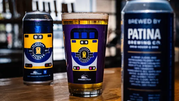
Platform Pilsner: Vancouver Transit Agency Releases... a Beer?
TransLink will receive a portion of every sale of the four-pack.
Toronto Weighs Cheaper Transit, Parking Hikes for Major Events
Special event rates would take effect during large festivals, sports games and concerts to ‘discourage driving, manage congestion and free up space for transit.”

Planetizen Federal Action Tracker
A weekly monitor of how Trump’s orders and actions are impacting planners and planning in America.

Map: Where Senate Republicans Want to Sell Your Public Lands
For public land advocates, the Senate Republicans’ proposal to sell millions of acres of public land in the West is “the biggest fight of their careers.”

Restaurant Patios Were a Pandemic Win — Why Were They so Hard to Keep?
Social distancing requirements and changes in travel patterns prompted cities to pilot new uses for street and sidewalk space. Then it got complicated.

Albuquerque Route 66 Motels Become Affordable Housing
A $4 million city fund is incentivizing developers to breathe new life into derelict midcentury motels.

DC Area County Eliminates Bus Fares
Montgomery County joins a growing trend of making transit free.

Platform Pilsner: Vancouver Transit Agency Releases... a Beer?
TransLink will receive a portion of every sale of the four-pack.
Urban Design for Planners 1: Software Tools
This six-course series explores essential urban design concepts using open source software and equips planners with the tools they need to participate fully in the urban design process.
Planning for Universal Design
Learn the tools for implementing Universal Design in planning regulations.
Heyer Gruel & Associates PA
JM Goldson LLC
Custer County Colorado
City of Camden Redevelopment Agency
City of Astoria
Transportation Research & Education Center (TREC) at Portland State University
Camden Redevelopment Agency
City of Claremont
Municipality of Princeton (NJ)