


Andres Sevstuk, lecturer at MIT and head of the City Form Research Group describes how the new Urban Network Analysis toolbox is "taking a much more rigorous approach to look at the work of urban design."
Sevstuk claims that his new data analysis package examines how the form of a city affects the life that goes on in it. The software analyzes attributes of various locations to measure their "reach," how many jobs, or residences are accessible when traveling by the street network; or "betweeness," a measure that can estimate the volume of foot traffic an area receives.
The program has already provided some counter intuitive insights. In a restaurant-dense area like Inman Square, the presence of competitors works to businesses' advantage: "The idea there is by forming a cluster, they manage to attract a much larger clientele than the sum of each one alone,'' he said.
Such tools can also give planners a better handle on how to rationally fix cities.
FULL STORY: Urban Analysis

New MIT Data Analysis Tool Aims To Rationalize Planning
Andres Sevstuk, lecturer at MIT and head of the City Form Research Group describes how the new Urban Network Analysis Toolbox is, "taking a much more rigorous approach to look at the work of urban design."
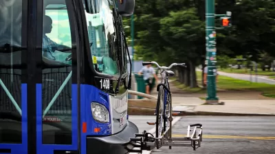
Boston's Data-Driven Bus System Makeover
MIT's Transit Lab created a ridership model called Origin Destination Transfer (ODX) that the Massachusetts Bay Transportation Authority is using to make incremental changes to the region's bus system.
What Makes Boston One of the Smartest Cities in the World?
Having two of the top universities in the world within a couple of miles of each other doesn't hurt. But Boyd Cohen looks at Boston's cutting-edge efforts to foster innovation within and outside of its universities, that make it a global leader.

Planetizen Federal Action Tracker
A weekly monitor of how Trump’s orders and actions are impacting planners and planning in America.

Map: Where Senate Republicans Want to Sell Your Public Lands
For public land advocates, the Senate Republicans’ proposal to sell millions of acres of public land in the West is “the biggest fight of their careers.”

Restaurant Patios Were a Pandemic Win — Why Were They so Hard to Keep?
Social distancing requirements and changes in travel patterns prompted cities to pilot new uses for street and sidewalk space. Then it got complicated.

Platform Pilsner: Vancouver Transit Agency Releases... a Beer?
TransLink will receive a portion of every sale of the four-pack.

Toronto Weighs Cheaper Transit, Parking Hikes for Major Events
Special event rates would take effect during large festivals, sports games and concerts to ‘discourage driving, manage congestion and free up space for transit.”

Berlin to Consider Car-Free Zone Larger Than Manhattan
The area bound by the 22-mile Ringbahn would still allow 12 uses of a private automobile per year per person, and several other exemptions.
Urban Design for Planners 1: Software Tools
This six-course series explores essential urban design concepts using open source software and equips planners with the tools they need to participate fully in the urban design process.
Planning for Universal Design
Learn the tools for implementing Universal Design in planning regulations.
Heyer Gruel & Associates PA
JM Goldson LLC
Custer County Colorado
City of Camden Redevelopment Agency
City of Astoria
Transportation Research & Education Center (TREC) at Portland State University
Camden Redevelopment Agency
City of Claremont
Municipality of Princeton (NJ)